Day 4-8 Convective Outlook
Issued: · Valid: –
Summary
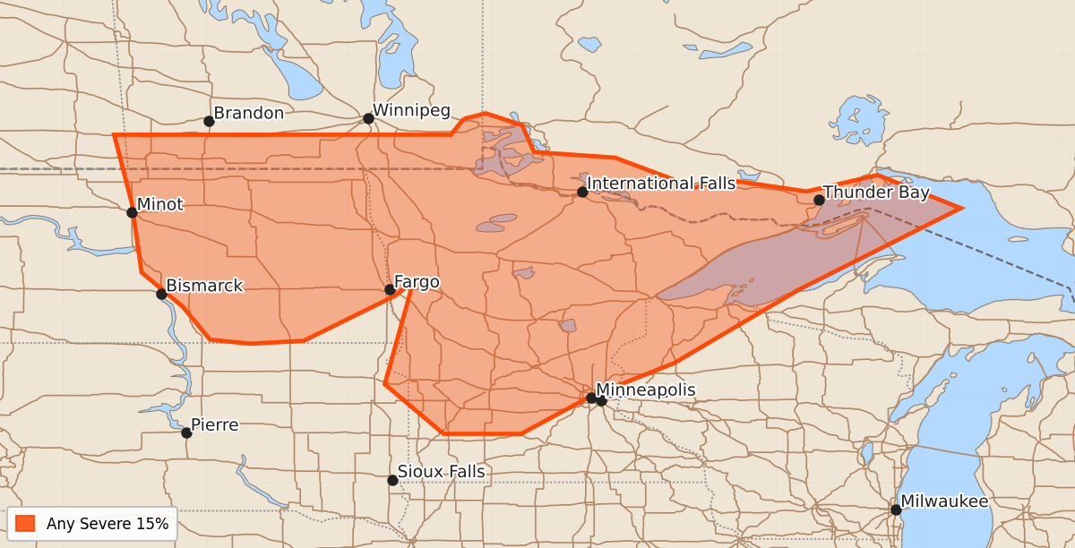
Severe storms are possible across eastern North Dakota and northwest Minnesota from Sunday afternoon through Sunday night. Potential severe weather may also extend into the Upper Midwest on Monday.
Product Text
000 ACUS48 KWNS 250811 SWOD48 SPC AC 250809 Day 4-8 Convective Outlook NWS Storm Prediction Center Norman OK 0309 AM CDT Thu Jun 25 2026 Valid 281200Z - 031200Z ...DISCUSSION... ...D4/Sun - Northern Plains... A strong mid-level jet streak is expected to round the base of the western CONUS trough on Sunday and emerge across the northern Plains. As this occurs, the lee cyclone across eastern Colorado will deepen further and move northward into the northern Plains by 12Z Monday. Continued northward moisture transport will result in strong to very strong instability ahead of the surface low across the northern Plains. Forecast soundings show a very favorable environment and an uncapped airmass by evening. Forecast specifics remain nebulous as individual shortwave troughs will impact the timing and coverage of storms, but severe storms are possible at some point Sunday afternoon to Sunday night across eastern North Dakota and into northwest Minnesota. ...D5/Mon - Upper Midwest... The primary shortwave trough and associated mid-level jet streak is forecast to shift northeastward across the northern Plains and toward the Upper Midwest on Monday. This will occur atop a very unstable airmass across a broad area of the Upper Midwest. Severe storms are possible, but the exact magnitude and extent of the threat will become more clear once individual shortwave troughs associated with this upper trough become better sampled. Beyond Day 5, the upper-level pattern becomes a bit more uncertain. Overall, a general pattern with a trough persisting over the Northwest or northern Rockies and a ridge over the Plains or Midwest seems most likely. However, the differences in amplitude and location of these features limit predictability. Within this broader pattern, severe weather will be most likely from the northern Rockies to the northern Plains and also potentially on the eastern periphery of the upper ridge across the Northeast. At this time, predictability is too low to add any probability areas. ..Bentley.. 06/25/2026