Mesoscale Discussion 2341
Issued: · Valid: –
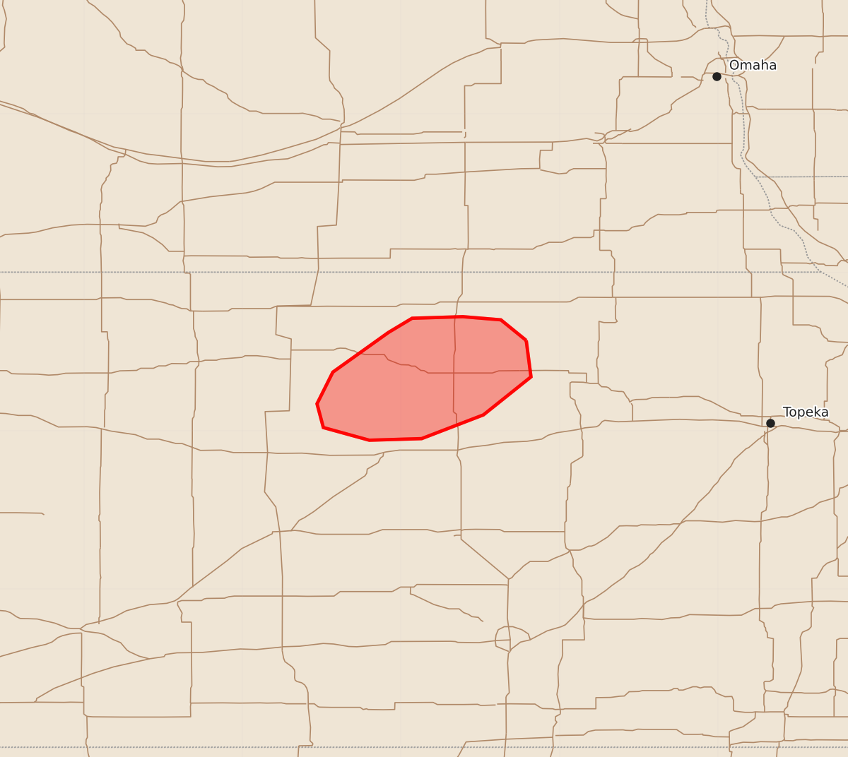
Summary
A tornado watch remains in effect for parts of north-central Kansas through early tonight, with the threat of brief tornadoes expected in several counties over the next two hours.
Product Text
000 ACUS11 KWNS 302348 SWOMCD SPC MCD 302347 KSZ000-010115- Mesoscale Discussion 2341 NWS Storm Prediction Center Norman OK 0647 PM CDT Wed Sep 30 2026 Areas affected...Parts of north-central Kansas Concerning...Tornado Watch 675... Valid 302347Z - 010115Z The severe weather threat for Tornado Watch 675 continues. SUMMARY...The most favorable corridor for tornadoes should be confined to several counties in north-central Kansas during the next couple of hours -- within the northern portion of Tornado Watch 675. DISCUSSION...The latest radar data shows a long-lived, loosely organized cluster of storms tracking northeastward in Russell and Lincoln Counties KS -- which has produced several periodic/mostly brief tornadoes. Ahead of this activity, a narrow corridor of surface-based buoyancy (albeit weak) remains in place amid an enlarged, clockwise-curved low-level hodograph (likely around 250-300 m2/s2 effective SRH per mesoanalysis and VWP data). As the cluster of storms continues northeastward, this will likely be the most favorable area for additional tornadoes during the next couple of hours -- before storms move into the cooler/stable air to the north. The environment remains conditionally favorable farther south where a warmer boundary layer is contributing to greater buoyancy. However, an approaching dry slot evident in WV imagery and the strongest low-level mass response shifting northward casts uncertainty on storm development here. ..Weinman.. 09/30/2026 ...Please see www.spc.noaa.gov for graphic product... ATTN...WFO...TOP...ICT...GID... LAT...LON 39579721 39349718 39109748 38959787 38949820 39029849 39179853 39379843 39629808 39719793 39729761 39709737 39579721 MOST PROBABLE PEAK TORNADO INTENSITY...85-110 MPH MOST PROBABLE PEAK WIND GUST...UP TO 60 MPH