Mesoscale Discussion 1150
Issued: · Valid: –
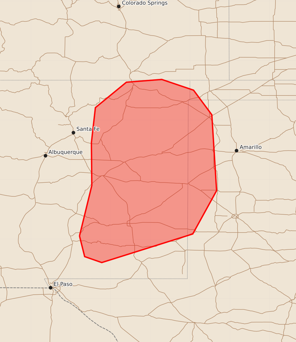
Summary
Increasing thunderstorm coverage in eastern New Mexico and the Texas Panhandle this afternoon and evening may bring marginally severe wind and hail.
Product Text
000 ACUS11 KWNS 151934 SWOMCD SPC MCD 151934 TXZ000-OKZ000-NMZ000-COZ000-152130- Mesoscale Discussion 1150 NWS Storm Prediction Center Norman OK 0234 PM CDT Mon Jun 15 2026 Areas affected...eastern New Mexico...Texas Panhandle Concerning...Severe potential...Watch unlikely Valid 151934Z - 152130Z Probability of Watch Issuance...20 percent SUMMARY...Thunderstorms to increase in coverage through the afternoon/evening posing a marginal risk for wind and hail. DISCUSSION...Thunderstorm activity is increasing in coverage along the high terrain in eastern New Mexico this afternoon. It is likely that activity will continue to develop in this region before clusters move off the high terrain and into portions of the Texas Panhandle through the late afternoon/evening. With a few more hours of additional heating, MLCAPE around 1000 J/kg should be available in the area across eastern New Mexico into the Texas Panhandle. Steep low to mid-level lapse rates and deep layer shear around 30-35 kts will support potential for a few instances of marginally severe hail with initial discrete cells and potential for damaging wind as clustering occurs into the evening. Overall, coverage of a more organized severe threat appears low and as such a watch is unlikely at this time. ..Thornton/Mosier.. 06/15/2026 ...Please see www.spc.noaa.gov for graphic product... ATTN...WFO...LUB...AMA...MAF...PUB...ABQ...EPZ... LAT...LON 33080578 34350547 35430548 36310538 36950460 37020371 36750291 36130245 34220233 33130293 32410522 32560565 33080578 MOST PROBABLE PEAK TORNADO INTENSITY...UP TO 90 MPH MOST PROBABLE PEAK WIND GUST...UP TO 60 MPH MOST PROBABLE PEAK HAIL SIZE...UP TO 1.25 IN