Mesoscale Discussion 2269
Issued: · Valid: –
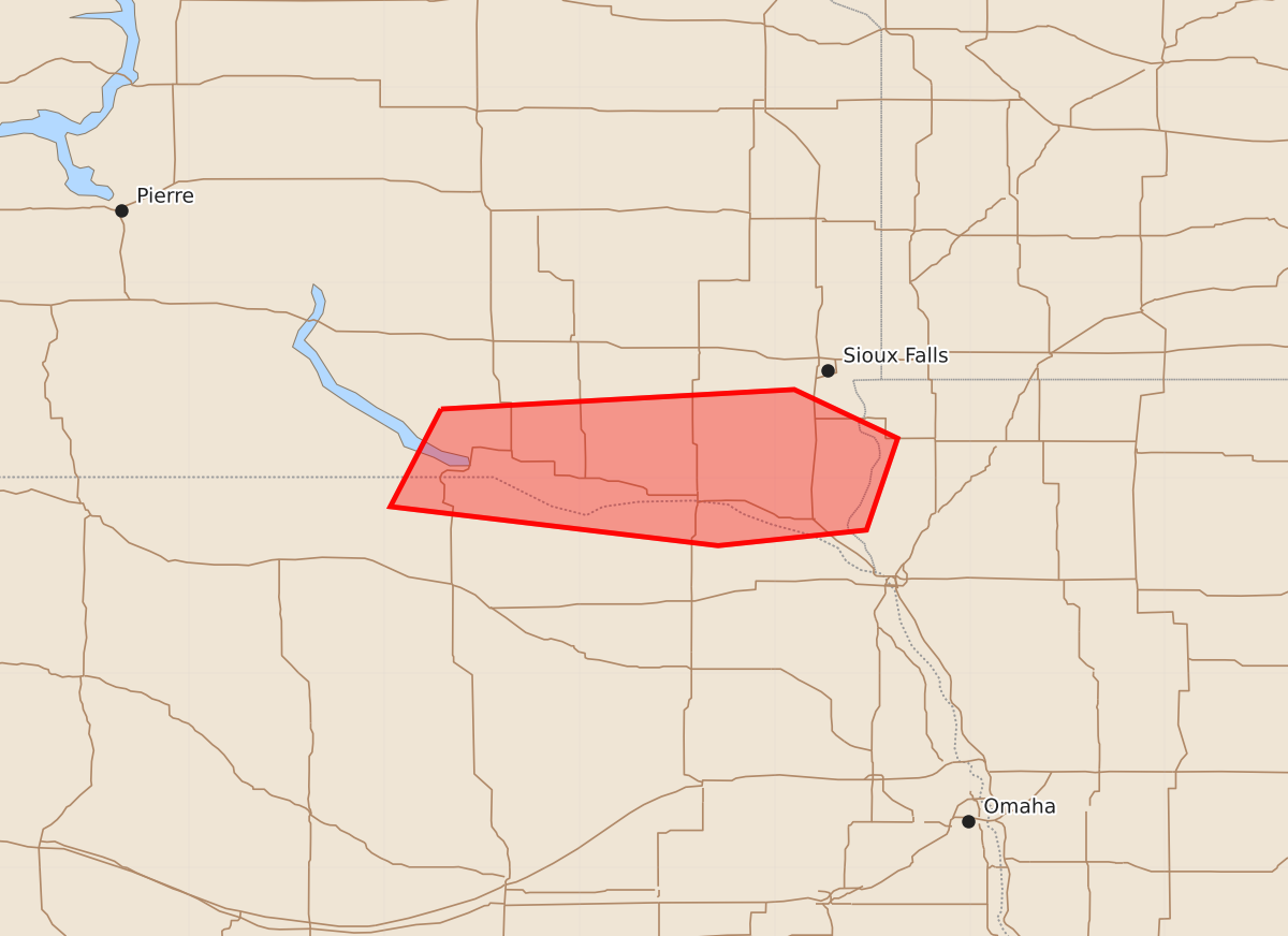
Summary
Localized strong wind gusts remain possible across parts of southeastern South Dakota and northeastern Nebraska through early morning hours. These storms may produce peak wind gusts between 55 and 70 mph.
Product Text
000 ACUS11 KWNS 080428 SWOMCD SPC MCD 080428 IAZ000-SDZ000-NEZ000-080630- Mesoscale Discussion 2269 NWS Storm Prediction Center Norman OK 1128 PM CDT Mon Sep 07 2026 Areas affected...parts of southeastern South Dakota...northeastern Nebraska and adjacent portions of the middle Missouri Valley Concerning...Severe Thunderstorm Watch 664... Valid 080428Z - 080630Z The severe weather threat for Severe Thunderstorm Watch 664 continues. SUMMARY...Localized strong wind gusts remain possible in lingering thunderstorm development, but the risk for severe weather, in general, appears to be waning. A new severe weather watch is not anticipated, but trends will continue to be monitored. DISCUSSION...Warm advection along a convective outflow reinforced, quasi-stationary low-level baroclinic zone, aided by a 40-45+ kt southerly 850 mb jet, has been providing support for a persistent band of convection. This has been focused southeast of Chamberlain through the Yankton vicinity, with perhaps some northward/eastward drift to the north of the Missouri River the past hour or two. Forecast soundings near this activity indicate the lingering presence of some combination of remnant elevated mixed-layer air and subsidence induced warming/drying in the the 850-700 mb layer. Entrainment of this air, and subsequent evaporative cooling and downward mixing of momentum, may have provided support for an eastward surging segment/small evolving cluster overspreading the Yankton vicinity. However, lapse rates near and just above the surface appear to have become stable enough to limit much more than rather localized strong surface gust potential. And this potential seems likely to wane further with continuing convective development into the 06-07Z time frame. ..Kerr.. 09/08/2026 ...Please see www.spc.noaa.gov for graphic product... ATTN...WFO...FSD...OAX...LBF... LAT...LON 43359871 43459690 43209637 42739653 42659729 42859897 43359871 MOST PROBABLE PEAK WIND GUST...55-70 MPH MOST PROBABLE PEAK HAIL SIZE...1.00-1.75 IN