Mesoscale Discussion 1651
Issued: · Valid: –
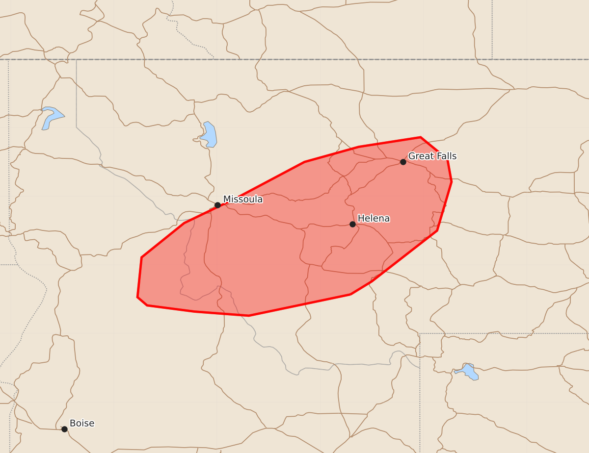
Summary
Isolated to widely scattered severe thunderstorms are expected across western Montana and central Idaho this afternoon and early evening, bringing a risk of damaging wind gusts and large hail.
Product Text
000 ACUS11 KWNS 181937 SWOMCD SPC MCD 181936 MTZ000-IDZ000-182100- Mesoscale Discussion 1651 NWS Storm Prediction Center Norman OK 0236 PM CDT Sat Jul 18 2026 Areas affected...Western Montana...central Idaho Concerning...Severe potential...Watch possible Valid 181936Z - 182100Z Probability of Watch Issuance...40 percent SUMMARY...Isolated to widely scattered severe thunderstorms are expected this afternoon and early evening with a risk for damaging gusts and large hail. Trends in storm coverage will be monitored and a Severe Thunderstorm Watch is possible. DISCUSSION...Isolated strong thunderstorms have developed in the vicinity of the ID/MT border west or Butte as of 1930z. This area is along the fringe of somewhat stronger mid-level flow associated with an upper low over southern British Columbia, and within a plume of monsoonal moisture along the periphery of an expansive mid-level ridge. Moderate instability, characterized by MLCAPE of 1000 to 1500 J/kg and 35-45 kts of southwesterly shear will be favorable for supercell and multicell storm structures. Damaging gusts, potentially in excess of 75 mph, will be the primary risk. Large hail is also possible with any persistent supercell. The primary uncertainty is storm coverage, and trends will continue to be monitored for the possibility of a Severe Thunderstorm Watch this afternoon. ..Bunting/Thompson.. 07/18/2026 ...Please see www.spc.noaa.gov for graphic product... ATTN...WFO...TFX...MSO... LAT...LON 45571206 45261354 45321433 45411502 45531516 46111510 46611448 46991369 47501273 47721194 47861104 47541065 47211059 46501080 45761175 45571206 MOST PROBABLE PEAK WIND GUST...65-80 MPH MOST PROBABLE PEAK HAIL SIZE...1.00-1.75 IN