Mesoscale Discussion 1336
Issued: · Valid: –
Summary
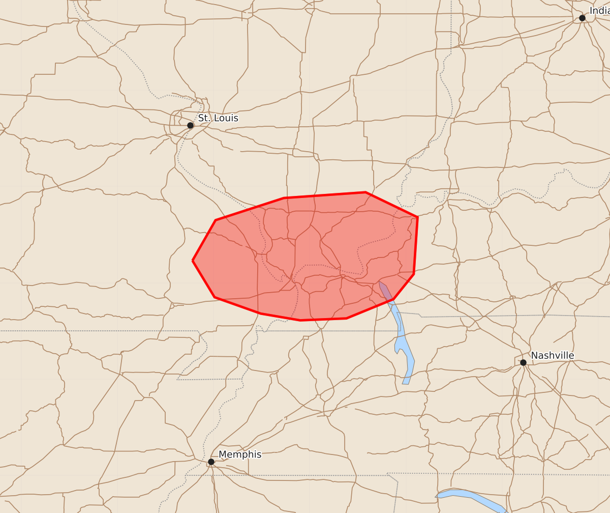
Severe thunderstorms capable of producing damaging winds and tornadoes are expected across southeast Missouri, southern Illinois, and western Kentucky through the early evening. These storms may produce wind gusts up to 70 mph and tornadoes with intensities between 85 and 110 mph.
Product Text
000 ACUS11 KWNS 262037 SWOMCD SPC MCD 262036 KYZ000-ILZ000-MOZ000-262230- Mesoscale Discussion 1336 NWS Storm Prediction Center Norman OK 0336 PM CDT Fri Jun 26 2026 Areas affected...southeast Missouri into southern Illinois and western Kentucky Concerning...Severe potential...Watch possible Valid 262036Z - 262230Z Probability of Watch Issuance...60 percent SUMMARY...The potential for a few severe storms capable of locally damaging winds and perhaps a few tornadoes appears to be increasing. Convective trends are being monitored for a possible watch. DISCUSSION...A small cluster of thunderstorms has recently intensified in the vicinity of I-55 near Cape Girardeau, on the southwest flank of a large-scale convective system collocated with an MCV. The ambient environment is quite moist and moderately unstable with MLCAPE estimated in the 1000-1500 J/kg range. The storms have exhibited some rotation amidst a modestly sheared environment, per the current KPAH VWP. However, latest short-term model guidance suggests that a southwesterly low-level jet will gradually strengthen late this afternoon into early evening, which will contribute to some increase in low-level shear. As such, tornado potential may tend to increase over the next hour or two, along with a risk for damaging wind gusts. Convective trends are being monitored for a possible watch issuance. ..Mead/Guyer.. 06/26/2026 ...Please see www.spc.noaa.gov for graphic product... ATTN...WFO...PAH...LSX... LAT...LON 37239022 37658998 37888927 37948842 37688788 37098792 36838813 36638862 36618910 36688951 36858999 37239022 MOST PROBABLE PEAK TORNADO INTENSITY...85-110 MPH MOST PROBABLE PEAK WIND GUST...55-70 MPH MOST PROBABLE PEAK HAIL SIZE...UP TO 1.25 IN