Mesoscale Discussion 1072
Issued: · Valid: –
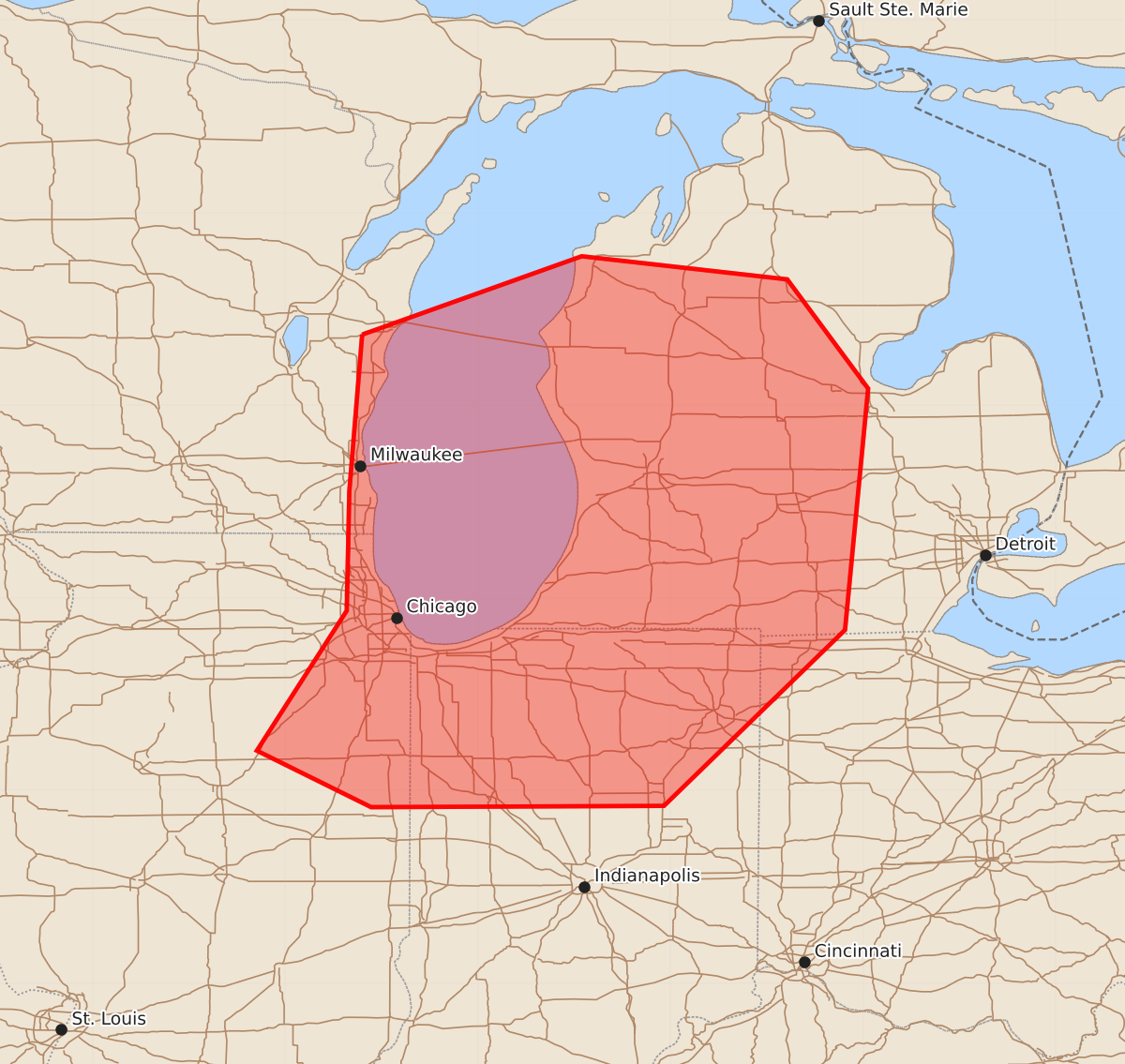
Summary
A severe mesoscale convective system capable of producing strong wind gusts is moving eastward toward west-central Michigan, northern Indiana, and northeastern Illinois this afternoon and evening. Expected hazards include severe wind gusts between 65 and 80 mph.
Product Text
000 ACUS11 KWNS 102058 SWOMCD SPC MCD 102058 MIZ000-OHZ000-INZ000-WIZ000-ILZ000-102300- Mesoscale Discussion 1072 NWS Storm Prediction Center Norman OK 0358 PM CDT Wed Jun 10 2026 Areas affected...west-central Michigan...northern Indiana...and northeastern Illinois Concerning...Severe potential...Watch likely Valid 102058Z - 102300Z Probability of Watch Issuance...80 percent SUMMARY...A severe mesoscale convective system is surging eastward over Lake Michigan toward central and southern MI. Watch issuance is likely in order to address the associated severe-wind threat. DISCUSSION...A mature mesoscale convective system (MCS) has developed and is surging eastward over Lake Michigan as of 2040z. Several strong-to-severe wind gusts have been reported in the last couple of hours, including an 82-kt gust at 2017z in Oshkosh, WI. The meridional portion of the line -- oriented orthogonal to 30-40-kt bulk shear vectors -- is expected to continue producing strong-to-severe wind gusts as it crosses Lake Michigan. Downstream of the lake, the environment in south-central MI (south of a warm front draped through the central part of the state) is characterized by very large MLCAPE (3000+ J/kg) and westerly bulk shear around 30 kts. The general expectation is for the associated mid-level impulse to persist eastward and support MCS maintenance into MI. Some uncertainty exists as to the eastward extent of the threat in MI, possibly due to inflow contamination from convection developing across central MI. MCS intensity will eventually wane after peak diurnal heating. However, confidence is relatively high in the short-term severe-wind threat continuing into MI, and a watch is likely warranted. ..Flournoy/Mosier.. 06/10/2026 ...Please see www.spc.noaa.gov for graphic product... ATTN...WFO...DTX...APX...IWX...GRR...IND...GRB...LOT...ILX... MKX... LAT...LON 44058790 44668619 44488459 43638396 41758414 40388555 40378783 40818872 41908802 42838800 44058790 MOST PROBABLE PEAK TORNADO INTENSITY...85-110 MPH MOST PROBABLE PEAK WIND GUST...65-80 MPH MOST PROBABLE PEAK HAIL SIZE...1.00-1.75 IN