Day 3 Convective Outlook
Issued: · Valid: –
Summary
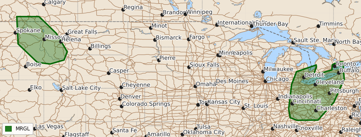
Marginal severe thunderstorms capable of producing hail and strong wind gusts are expected Saturday across portions of the Northern Rockies and the Ohio Valley.
Product Text
000 ACUS03 KWNS 201917 SWODY3 SPC AC 201915 Day 3 Convective Outlook NWS Storm Prediction Center Norman OK 0215 PM CDT Thu Aug 20 2026 Valid 221200Z - 231200Z ...THERE IS A MARGINAL RISK OF SEVERE THUNDERSTORMS ACROSS PORTIONS OF THE NORTHERN ROCKIES...AND THE OHIO VALLEY... ...SUMMARY... Afternoon storms may produce marginal hail or wind gusts from the Upper Ohio Valley to the Lower Great Lakes, and over parts of the Northwest on Saturday. ...Midwest... An upper trough will dig and pivot southeast across the region on Saturday. At the surface, a front will extend from Lower MI to southern IL at the start of the period, with the boundary tracking east/southeast across the Ohio Valley through early Sunday. Ahead of the boundary, 60s F surface dewpoints beneath cooler midlevel temperatures will support moderate destabilization by afternoon. Widely scattered thunderstorms are expected to develop along the surface boundary and spread southeast through evening. This activity will pose a risk for marginal hail and strong wind gusts. ...Northern Rockies... An upper shortwave trough will move across the Pacific Northwest and northern Rockies on Saturday. This will bring enhanced southwesterly flow and cooling aloft over much of the region. Steepening midlevel lapse rates will support weak destabilization, and isolated to widely scattered thunderstorms are expected. A deeply mixed boundary layer beneath strengthening flow aloft will support strong outflow winds with this activity. Small hail could also occur with stronger cells. ...Lower MO Valley to AR/Mid-South... Enhanced northwesterly flow aloft will persist over the region on Saturday. A surface front will drop southward across MO/IL into the Ozarks and Mid-South vicinity. Ahead of the front, a seasonally moist airmass will be in place, and moderate to strong instability is forecast. Some forecast guidance suggests a remnant MCV or outflow from prior convection could focus thunderstorm develop along the sagging surface front. Where the greatest coverage of thunderstorms occurs remains highly uncertain. If confidence increases in subsequent outlooks, wind probabilities could be needed for portions of the region. ..Leitman.. 08/20/2026 $$