Mesoscale Discussion 0996
Issued: · Valid: –
Product Text
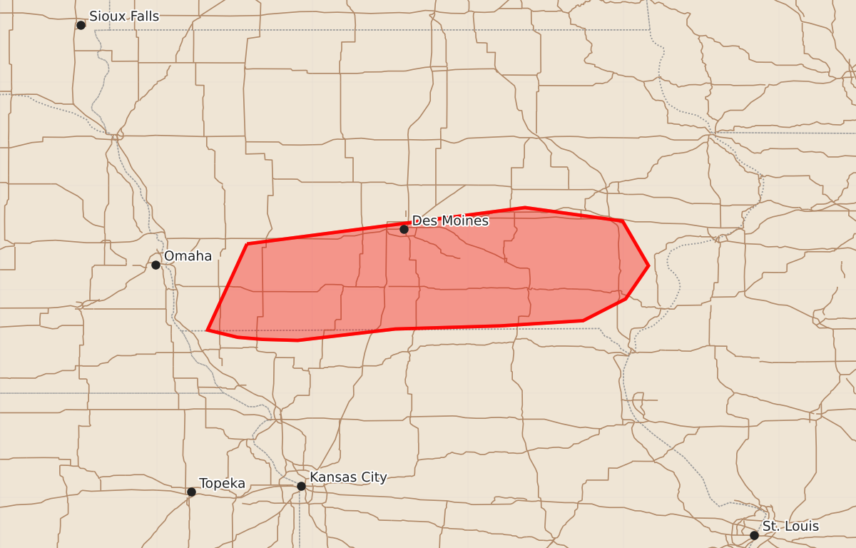
000 ACUS11 KWNS 060434 SWOMCD SPC MCD 060433 IAZ000-MOZ000-060600- Mesoscale Discussion 0996 NWS Storm Prediction Center Norman OK 1133 PM CDT Fri Jun 05 2026 Areas affected...southern Iowa Concerning...Severe Thunderstorm Watch 276... Valid 060433Z - 060600Z The severe weather threat for Severe Thunderstorm Watch 276 continues. SUMMARY...Severe storms continue across WW276. A stronger cluster moving in from the west should transition the threat to mostly damaging winds. Some hail and a brief tornado remain possible. DISCUSSION...Over the last several hours, severe storms, including a few supercells have organized across portions of southern IA. These storms have been largely stationary, tied to stronger ascent near a diffuse surface boundary. The environment remains quite unstable and sufficiently sheared for supercell structures. This will support a continued risk for hail and isolated damaging gusts. A larger convective cluster is moving eastward out of WW275. These storms have a history of producing severe wind gusts, and will interact with the ongoing storms over IA in the next few hours. Strong outflow from this forward propagating cluster will likely favor a damaging wind risk as convection consolidates and the cold pool continues to strengthen. A brief tornado also remains possible as strong outflow interacts with any of the more persistent supercells. Thus, the severe risk will continue for much of WW276 this evening and early overnight period. ..Lyons.. 06/06/2026 ...Please see www.spc.noaa.gov for graphic product... ATTN...WFO...DVN...DMX...EAX...OAX... LAT...LON 41449513 41799245 41669151 41239126 40919148 40709189 40659269 40629370 40519464 40529498 40549522 40619551 41449513 MOST PROBABLE PEAK TORNADO INTENSITY...UP TO 90 MPH MOST PROBABLE PEAK WIND GUST...55-70 MPH MOST PROBABLE PEAK HAIL SIZE...1.00-1.75 IN