Mesoscale Discussion 1742
Issued: · Valid: –
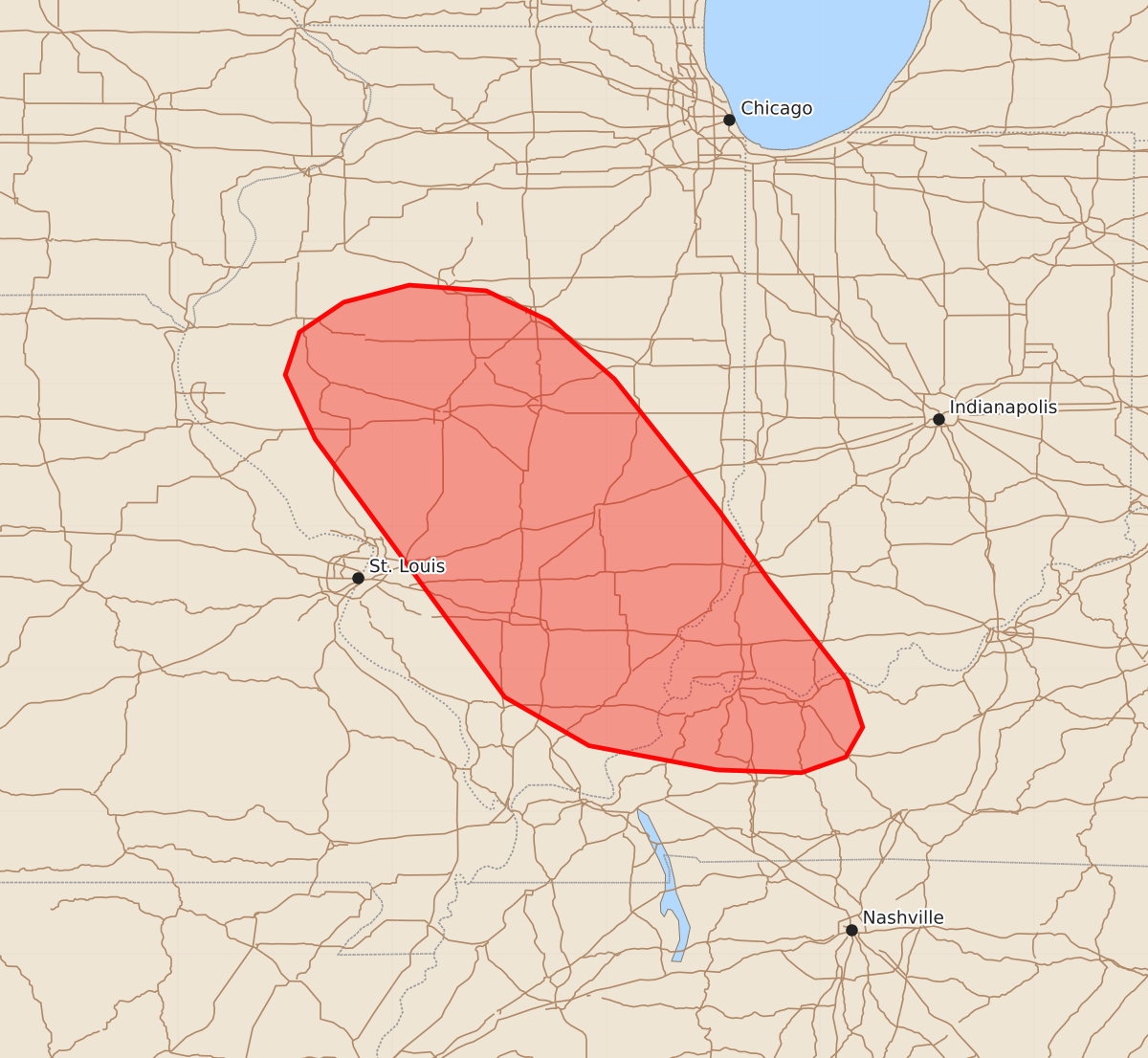
Summary
Isolated thunderstorms with the potential for severe winds, hail, and tornadoes may develop over southern Illinois, western Kentucky, and far southwest Indiana later this afternoon and into the evening. The severity of these storms is expected to increase as they organize into a more widespread system.
Product Text
000 ACUS11 KWNS 261853 SWOMCD SPC MCD 261852 KYZ000-INZ000-ILZ000-262115- Mesoscale Discussion 1742 NWS Storm Prediction Center Norman OK 0152 PM CDT Sun Jul 26 2026 Areas affected...Illinois and portions of far southwest Indiana and western Kentucky Concerning...Severe potential...Watch possible Valid 261852Z - 262115Z Probability of Watch Issuance...60 percent SUMMARY...Isolated convection is developing within a very unstable air mass over southern IL, but it is unclear when a more pronounced severe threat will emerge. Trends are being monitored, and watch issuance will likely be needed by late afternoon, though timing remains uncertain. DISCUSSION...An isolated convective cell has recently developed across south-central IL within a highly unstable air mass (characterized by MLCAPE values of 4500-5000 J/kg based on the recent 18 UTC DVN sounding). However, this cell is spatially displaced from more focused low-level convergence/forcing for ascent along a differential heating axis analyzed from western KY/southwest IN into central and northern IL. Because of this (and based on reflectivity trends over the past 20 minutes), it appears unlikely that this cell will pose much of a severe threat. Recent iterations of the RRFS actually seem to be capturing convective trends well and depict this lone cell developing and decaying within the next hour or so before additional convection develops along the surface boundary and ahead of a subtle mid-level perturbation approaching from central IA during the 20-22 UTC period. Recent GOES imagery shows gradual cumulus growth along the boundary in southern IL as well as slow deepening of cumulus across southeast IA/northeast MO, which lends credibility to the recent RRFS solutions. Additional convection developing later this afternoon will likely fully realize the favorable thermodynamic and kinematic environment (characterized by SCP values of 8-12) draped across central IL into the lower OH Valley. Guidance continues to depict relatively quick upscale growth into an organized MCS by early evening with an attendant threat for severe winds. Watch issuance will be needed this afternoon/evening, but exact timing will depend on when more widespread thunderstorm initiation becomes apparent. ..Moore/Leitman.. 07/26/2026 ...Please see www.spc.noaa.gov for graphic product... ATTN...WFO...LMK...IND...PAH...ILX...LSX...DVN... LAT...LON 37298772 37468862 37808921 39619054 40069075 40369065 40579034 40698988 40658934 40448890 40038844 39118771 38618735 37928681 37598670 37388682 37278713 37298772 MOST PROBABLE PEAK TORNADO INTENSITY...UP TO 90 MPH MOST PROBABLE PEAK WIND GUST...55-70 MPH MOST PROBABLE PEAK HAIL SIZE...UP TO 1.25 IN