Mesoscale Discussion 1751
Issued: · Valid: –
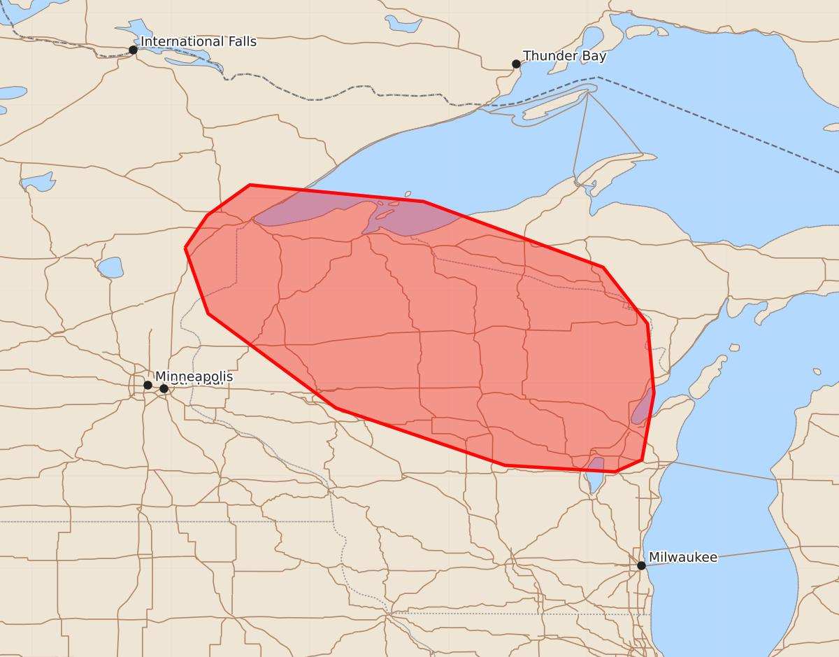
Summary
Severe thunderstorms with the potential for damaging winds, large hail, and tornadoes may develop across portions of northern Wisconsin and western Upper Michigan late tonight. The severity of these storms is uncertain and depends on whether they organize into a larger convective system.
Product Text
000 ACUS11 KWNS 270129 SWOMCD SPC MCD 270128 MIZ000-WIZ000-MNZ000-270300- Mesoscale Discussion 1751 NWS Storm Prediction Center Norman OK 0828 PM CDT Sun Jul 26 2026 Areas affected...portions of central and northern Wisconsin into western parts of Upper Michigan Concerning...Severe potential...Watch possible Valid 270128Z - 270300Z Probability of Watch Issuance...60 percent SUMMARY...The severe threat may be increasing across portions of northern WI. If storms can mature and develop into an MCS, a severe wind swath may occur. A WW issuance may be needed, but this depends on further development and intensification of storms. DISCUSSION...A complex mesoscale scenario exists across northern portions of WI, where there is a conditional risk for supercells growing upscale into an MCS over the next couple of hours. Storms within a low-level warm-air advection regime have begun to rapidly track towards an elongated corridor of strong instability (up to 4000 J/kg MLCAPE driven by 7-8 C/km mid-level lapse rates atop mid 70s F dewpoints), and up to 50 kts of effective bulk shear (shown by the GRB 00z observed sounding and 01Z mesoanalysis). Nonetheless, appreciable MLCINH and multiple outflow boundaries and/or stabilizing lake-breezes also exist across the warm sector in northern WI, which is also being grazed by a plume of smoke originating from Canada. All of these factors have the capability of limiting further convective development. Therefore, it is unclear if the ongoing storms will intensify and impose a more immediate severe threat, or if a greater severe threat will manifest from storms that develop later this evening. Some of the latest CAM guidance, including WoFs, suggests that the main severe threat will materialize after 06Z. As such, the short-term severe threat is highly uncertain, but given the volatility of the ambient environment, convective trends will be closely monitored for the need of a WW issuance. ..Squitieri/Smith.. 07/27/2026 ...Please see www.spc.noaa.gov for graphic product... ATTN...WFO...MQT...GRB...DLH...ARX...MPX... LAT...LON 46469285 46819261 47149215 46969027 46258833 45648785 44898778 44178791 44048820 44118939 44739122 45759260 46469285 MOST PROBABLE PEAK TORNADO INTENSITY...85-110 MPH MOST PROBABLE PEAK WIND GUST...75-90 MPH MOST PROBABLE PEAK HAIL SIZE...2.00-3.50 IN