Mesoscale Discussion 1896
Issued: · Valid: –
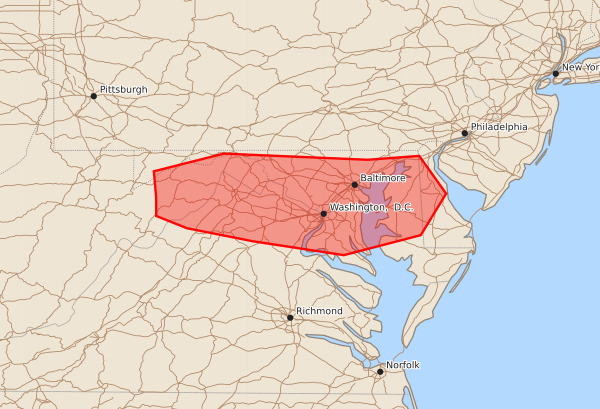
Summary
Damaging wind gusts from severe thunderstorms are expected to increase across the Maryland and West Virginia panhandles into the Delmarva peninsula this afternoon. These storms may produce wind gusts of 55 to 70 mph.
Product Text
000 ACUS11 KWNS 101700 SWOMCD SPC MCD 101659 DEZ000-MDZ000-DCZ000-VAZ000-WVZ000-101900- Mesoscale Discussion 1896 NWS Storm Prediction Center Norman OK 1159 AM CDT Mon Aug 10 2026 Areas affected...the Maryland and West Virginia Panhandles into the Delmarva Concerning...Severe potential...Watch likely Valid 101659Z - 101900Z Probability of Watch Issuance...80 percent SUMMARY...The threat for locally damaging winds is expected to increase this afternoon, likely requiring a severe thunderstorm watch issuance. DISCUSSION...Daytime heating combined with boundary-layer dewpoints in the upper 60s to lower 70s has contributed to a moderately unstable air mass as of early afternoon with steepening low-level lapse rates and MLCAPE of 1500-2500 J/kg. Upstream convection over southwest PA is gradually developing a tighter leading-edge reflectivity gradient and more robust trailing stratiform region, suggestive of an organizing cold pool. Current thinking is that the evolving convective system will further intensify as it continues east-southeast and encounters an increasingly unstable environment across the discussion area. The current KPBZ VWP is sampling strengthening west-northwest flow above 2 km AGL, which will likely aid in further cold pool organization. These factors will lead to an increasing threat for damaging wind gusts across the area this afternoon, likely requiring the issuance of a severe thunderstorm watch. ..Mead/Hart.. 08/10/2026 ...Please see www.spc.noaa.gov for graphic product... ATTN...WFO...PHI...AKQ...LWX... LAT...LON 39117919 39457922 39687831 39607644 39657577 39167542 38627575 38367675 38547793 38717879 38877919 39117919 MOST PROBABLE PEAK WIND GUST...55-70 MPH MOST PROBABLE PEAK HAIL SIZE...UP TO 1.25 IN