Mesoscale Discussion 1736
Issued: · Valid: –
Summary
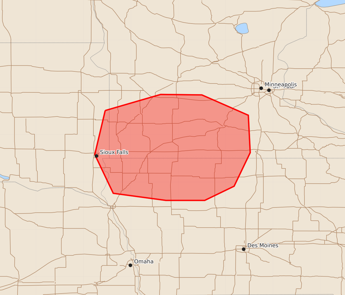
Severe thunderstorms capable of producing 90 mph wind gusts and 1-inch hail are expected across southwest and south-central Minnesota and northwest and north-central Iowa this evening.
Product Text
000 ACUS11 KWNS 260046 SWOMCD SPC MCD 260045 MNZ000-IAZ000-SDZ000-260245- Mesoscale Discussion 1736 NWS Storm Prediction Center Norman OK 0745 PM CDT Sat Jul 25 2026 Areas affected...Southwest/South-Central Minnesota...Northwest/North-Central Iowa Concerning...Severe potential...Watch likely Valid 260045Z - 260245Z Probability of Watch Issuance...95 percent SUMMARY...Threat for severe gusts up to 90 mph and large hail around 1 inch in diameter will persist across southwest/south-central Minnesota and northwest/north-central Iowa this evening. A Severe Thunderstorm Watch will be issued downstream to cover these convective hazards. DISCUSSION...Ongoing convective cluster continues to progress eastward across southeast South Dakota at around 35 kt. This speed has been fairly stead over the past hour or so, suggesting the line has not intensified. Even so, several severe gusts have been measured, including 70 mph in Douglas County. A recent increase in echo tops near the center of the line suggests some additional strengthening may be underway. Given the ample low-level moisture downstream (i.e. dewpoints in the upper 70s/low 80s) and extreme buoyancy (i.e. MLCAPE over 3500 J/kg) this strengthening would likely continue, with an attendant threat for severe wind gusts across southwest/south-central Minnesota and northwest/north-central Iowa. Isolated instances of hail are possible as well. A Severe Thunderstorm Watch will be issued downstream to cover these convective hazards. ..Mosier/Hart.. 07/26/2026 ...Please see www.spc.noaa.gov for graphic product... ATTN...WFO...MPX...DMX...FSD...ABR... LAT...LON 44519654 44859537 44849450 44419352 43629348 42919382 42619444 42619526 42769637 43589676 44519654 MOST PROBABLE PEAK TORNADO INTENSITY...UP TO 90 MPH MOST PROBABLE PEAK WIND GUST...75-90 MPH MOST PROBABLE PEAK HAIL SIZE...UP TO 1.25 IN