Day 3 Convective Outlook
Issued: · Valid: –
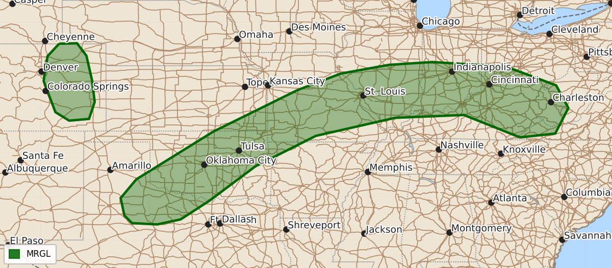
Summary
Isolated severe thunderstorms capable of producing wind and hail are possible across parts of the central High Plains, southern Plains, and the Midwest to the Ohio Valley on Sunday.
Product Text
000 ACUS03 KWNS 181927 SWODY3 SPC AC 181926 Day 3 Convective Outlook NWS Storm Prediction Center Norman OK 0226 PM CDT Fri Sep 18 2026 Valid 201200Z - 211200Z ...THERE IS A MARGINAL RISK OF SEVERE THUNDERSTORMS FROM THE SOUTHERN PLAINS TO THE OHIO VALLEY...AND EAST OF THE COLORADO FRONT RANGE... ...SUMMARY... Isolated severe thunderstorms, accompanied by mainly a wind and hail threat, are possible across portions of the central High Plains, the southern Plains, and the Midwest to Ohio Valley on Sunday. ...Synopsis... In the wake of a northern stream shortwave trough crossing New England, a surface cold front will move southeastward into the Mid-Atlantic, lower OH Valley and southern Plains by early Monday. The frontal location will be modulated by prior convective outflows, and it will reside beneath a belt of somewhat enhanced (~30 kt) midlevel flow with embedded perturbations. Predictability of thunderstorm clusters is low in this flow regime, so will maintain low severe probabilities along the frontal zone where steep low-level lapse rates and water loaded downdrafts will favor the potential for a few strong-severe outflow gusts. Upslope flow will help keep low-level moisture close to the Front Range, with cooler temperatures and weaker buoyancy/stronger convective inhibition farther east into the Plains. The passage of a weakening midlevel trough during the afternoon will provide weak ascent and sufficient deep-layer vertical shear for supercells capable of producing isolated large hail and strong outflow gusts. ..Thompson.. 09/18/2026 $$