Mesoscale Discussion 1101
Issued: · Valid: –
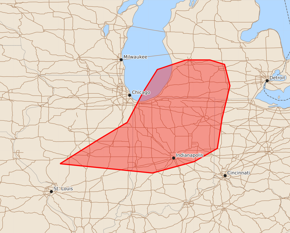
Summary
Damaging winds and tornadoes are possible across southwest lower Michigan, central and northern Indiana, far western Ohio, and eastern Illinois throughout the evening. These storms may bring wind gusts up to 90 mph, large hail, and intense tornadoes.
Product Text
000 ACUS11 KWNS 112339 SWOMCD SPC MCD 112338 MIZ000-OHZ000-INZ000-ILZ000-120115- Mesoscale Discussion 1101 NWS Storm Prediction Center Norman OK 0638 PM CDT Thu Jun 11 2026 Areas affected...Southwest Lower Michigan...central and northern Indiana...far western Ohio and eastern Illinois. Concerning...Severe potential...Watch needed soon Valid 112338Z - 120115Z Probability of Watch Issuance...95 percent SUMMARY...A tornado watch will be issued within the hour east of tornado watch 313. DISCUSSION...Instability continues to increase across northern Indiana and into southern Michigan as the outflow boundary from earlier convection continues to modify/lift northward. South of this boundary, an environment similar to the 21Z ILX RAOB is present with near 4000 J/kg MLCAPE. Along and north of the boundary instability is more limited, but shear is very strong with 250 m2/s2 0-1 km SRH and strong low-level clockwise curvature per an 22Z RAOB launched by the Valparaiso University Meteorological Department in Valparaiso, Indiana. Along and south of this boundary, widespread damaging winds are likely along a squall line this evening. In addition, embedded QLCS tornadoes and occasional embedded supercell tornadoes will be possible through the evening given the presence of strong low-level shear. The last few runs of the HRRR hint at some pre-frontal convection ahead of the line across central/northern Indiana later this evening, likely in response to the strengthening low-level jet. It is uncertain whether this will occur, or have sufficient time to mature before being caught by the main squall line, but these storms could pose an additional supercell tornado threat later this evening. ..Bentley/Smith.. 06/11/2026 ...Please see www.spc.noaa.gov for graphic product... ATTN...WFO...ILN...DTX...IWX...GRR...IND...LOT...ILX... LAT...LON 39568995 40378866 40948771 41958718 42708671 43028575 43028496 42878447 42168429 41088455 40078471 39638548 39258687 39568995 MOST PROBABLE PEAK TORNADO INTENSITY...120-145 MPH MOST PROBABLE PEAK WIND GUST...75-90 MPH MOST PROBABLE PEAK HAIL SIZE...1.00-1.75 IN