Mesoscale Discussion 2308
Issued: · Valid: –
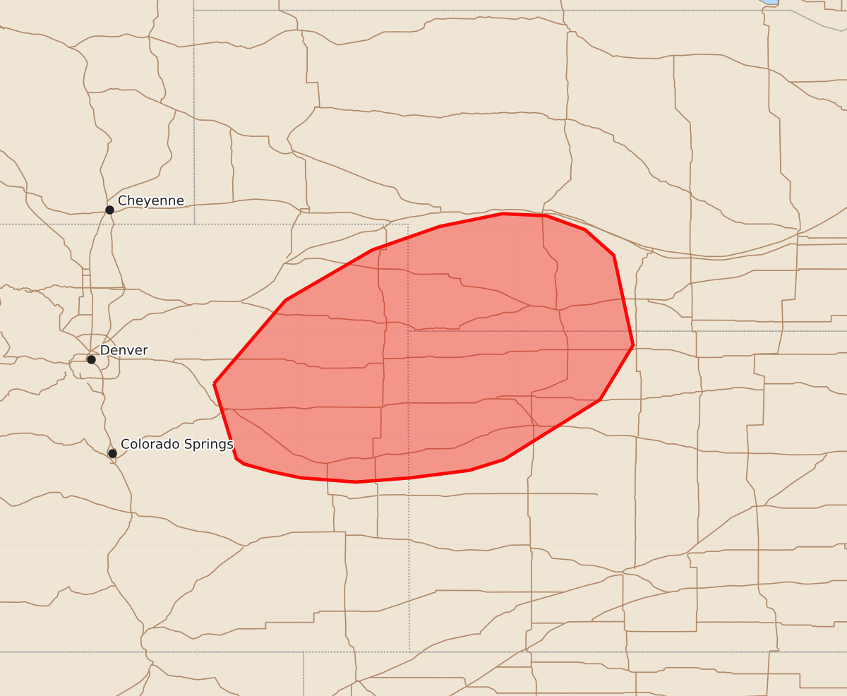
Summary
Isolated hail and wind may occur across eastern Colorado, southwestern Nebraska, and northwestern Kansas through the evening. These storms could produce wind gusts up to 60 mph and hail up to 1.25 inches.
Product Text
000 ACUS11 KWNS 182146 SWOMCD SPC MCD 182145 NEZ000-KSZ000-COZ000-182345- Mesoscale Discussion 2308 NWS Storm Prediction Center Norman OK 0445 PM CDT Fri Sep 18 2026 Areas affected...eastern Colorado into southwestern Nebraska and northwestern Kansas Concerning...Severe potential...Watch unlikely Valid 182145Z - 182345Z Probability of Watch Issuance...5 percent SUMMARY...Isolated wind and hail risk may continue into the evening. DISCUSSION...Isolated supercells have developed within the upslope regime south of a stationary front across eastern Colorado. Storm coverage will continue to increase as forcing for ascent overspreads the region from the western trough. Moisture across eastern Colorado remains somewhat limited, with dew points in the low to mid-50s F and around 250-500 J/kg of MLCAPE. Nonetheless, steep low to mid-level lapse rates may support a few instances of hail and wind. Higher theta-e air is in place across portions of western Kansas and Nebraska. As storms tend to cluster and move eastward through the evening, some damaging wind potential may spread eastward. Overall, this threat looks to remain too isolated for watch issuance. ..Thornton/Hart.. 09/18/2026 ...Please see www.spc.noaa.gov for graphic product... ATTN...WFO...GID...LBF...GLD...PUB...BOU... LAT...LON 39510384 40290317 40760236 40980173 41100114 41080073 40950037 40710010 39879992 39360023 38800113 38700145 38630200 38590251 38630303 38690331 38760356 38810363 39510384 MOST PROBABLE PEAK WIND GUST...UP TO 60 MPH MOST PROBABLE PEAK HAIL SIZE...UP TO 1.25 IN