Mesoscale Discussion 1261
Issued: · Valid: –
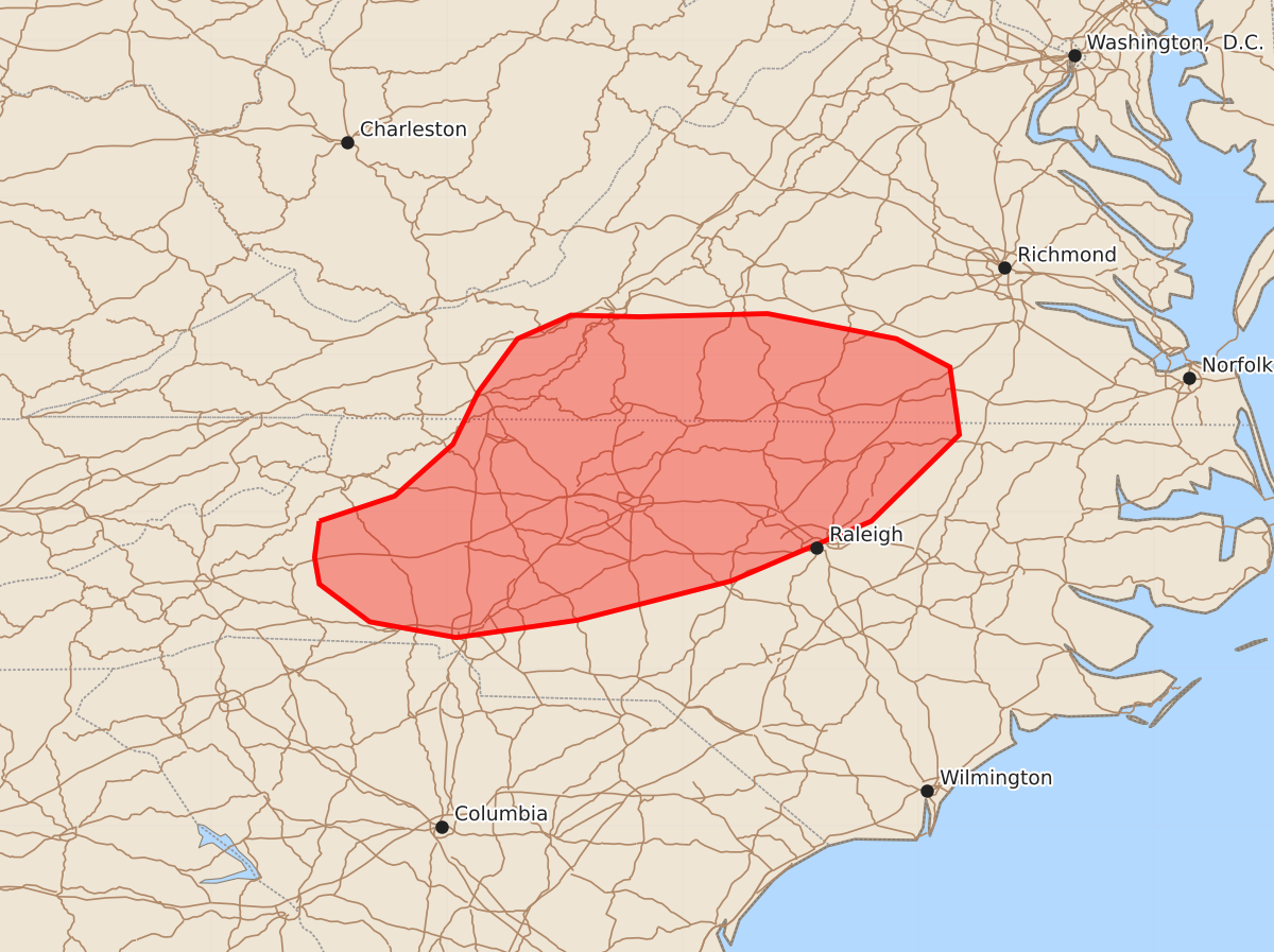
Summary
A line of thunderstorms moving through central North Carolina and southern Virginia could produce damaging straight-line winds of 55 to 70 mph through the early evening.
Product Text
000 ACUS11 KWNS 222151 SWOMCD SPC MCD 222150 NCZ000-VAZ000-222345- Mesoscale Discussion 1261 NWS Storm Prediction Center Norman OK 0450 PM CDT Mon Jun 22 2026 Areas affected...Central North Carolina into Southern Virginia Concerning...Severe potential...Watch possible Valid 222150Z - 222345Z Probability of Watch Issuance...60 percent SUMMARY...A loosely organized line of thunderstorms is moving eastward into portions of central North Carolina/southern Virginia. Damaging straight-line winds -- especially along any bowing segments or with interacting outflows -- will be possible through this evening. DISCUSSION...A loosely organized line of thunderstorms in western North Carolina and portions of southwestern Virginia will continue to move east through the late afternoon and into the early evening. Strong daytime heating has resulted in surface temperatures reaching the low-to-mid 90s F, and proximity RAP soundings show a deep and well-mixed boundary layer with LCLs exceeding 1800 meters. As a result, DCAPE values exceed 1200 J/kg ahead of these storms and should support strong downdrafts. Though current VAD wind profiles from Roanoke and Wakefield show small, disorganized hodographs, mesoanalysis shows around 30 kts of effective layer shear that will support continued loose organization with eastward extent. Given the 30 kts of deep-layer shear and strong DCAPE, sustained and strong downdrafts could produce 55-70 MPH winds through the early evening. A severe thunderstorm watch is being considered to cover this threat. ..Halbert.. 06/22/2026 ...Please see www.spc.noaa.gov for graphic product... ATTN...WFO...AKQ...RAH...RNK...GSP... LAT...LON 35948181 36108133 36438096 36768080 37108055 37258021 37247977 37267896 37107814 36927780 36497774 35947830 35567919 35318017 35208094 35308149 35548181 35718184 35948181 MOST PROBABLE PEAK WIND GUST...55-70 MPH MOST PROBABLE PEAK HAIL SIZE...UP TO 1.25 IN