Mesoscale Discussion 1366
Issued: · Valid: –
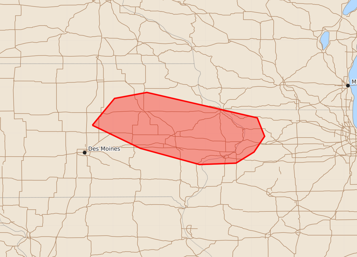
Summary
Severe thunderstorms capable of producing damaging winds and large hail are possible for parts of central to eastern Iowa and northwest Illinois late this morning into early afternoon. Expected severity includes wind gusts of 55-70 mph and hail up to 1.75 inches.
Product Text
000 ACUS11 KWNS 281514 SWOMCD SPC MCD 281514 ILZ000-IAZ000-WIZ000-281715- Mesoscale Discussion 1366 NWS Storm Prediction Center Norman OK 1014 AM CDT Sun Jun 28 2026 Areas affected...parts of Central into Eastern Iowa into northwest Illinois Concerning...Severe potential...Watch possible Valid 281514Z - 281715Z Probability of Watch Issuance...40 percent SUMMARY...Convective trends are being monitored for a possible increase in damaging wind potential by late morning into early afternoon. A Severe Thunderstorm Watch is possible. DISCUSSION...On the southern flank of a long-lived MCS, a more intense storm has recently developed near Ames, IA, within a pronounced low-level warm advection pattern, per KDMX VWP. Mesoanalysis suggests that the storm is located in close proximity to a stationary front that extends southeast through southeast IA into central IL. The air mass south of the boundary is very moist with the presence of steep mid-level lapse rates yielding a moderately unstable environment with MLCAPE upwards of 2000 J/kg. The main uncertainty is whether the current storms will become fully rooted within the boundary layer given the expected strengthening of the cap at the base of an EML through the day. The 12Z CAMs offer various scenarios with regard to convective evolution this morning but by afternoon largely agree that the strengthening cap will become prohibitive to surface-based storm development. However, in the event this more recent storm development can establish a cold pool, the background environment appears supportive of damaging wind potential in addition to some large hail threat. ..Mead/Guyer.. 06/28/2026 ...Please see www.spc.noaa.gov for graphic product... ATTN...WFO...DVN...ARX...DMX... LAT...LON 42179345 42759297 42889227 42338988 41938972 41598995 41359034 41329113 41679241 42179345 MOST PROBABLE PEAK WIND GUST...55-70 MPH MOST PROBABLE PEAK HAIL SIZE...1.00-1.75 IN