Mesoscale Discussion 1296
Issued: · Valid: –
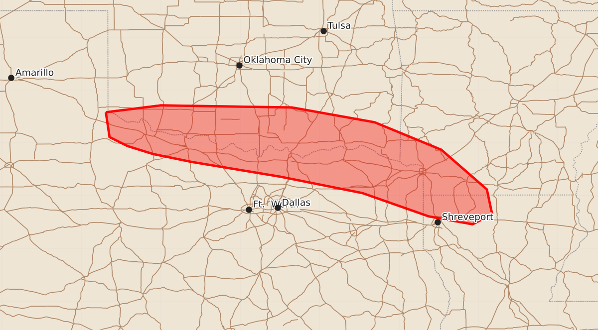
Summary
Isolated severe wind, hail, and possible tornadoes may occur across far southern Oklahoma, far northern Texas, extreme southwestern Arkansas, and extreme northwestern Louisiana through late evening. These storms are expected to be infrequent and carry a low probability of development.
Product Text
000 ACUS11 KWNS 242215 SWOMCD SPC MCD 242214 ARZ000-LAZ000-TXZ000-OKZ000-242345- Mesoscale Discussion 1296 NWS Storm Prediction Center Norman OK 0514 PM CDT Wed Jun 24 2026 Areas affected...portions of far southern Oklahoma into far northern Texas...extreme southwestern Arkansas and extreme northwestern Louisiana Concerning...Severe potential...Watch unlikely Valid 242214Z - 242345Z Probability of Watch Issuance...20 percent SUMMARY...An isolated severe wind/hail risk exists along a baroclinic boundary under the condition that storms can initiate and organize. DISCUSSION...A quasi-stationary baroclinic boundary currently resides just north of the Red River along much of far southern OK. Despite weak synoptic forcing for ascent, extreme buoyancy (4000+ J/kg MLCAPE) and minimal MLCINH with 40+ kts of effective bulk shear is coinciding with the boundary per 21Z mesoanalysis. As such, any storm that manages to develop and sustain itself will have the potential to produce severe wind/hail or perhaps a tornado. A storm has recently initiated over Atoka County, OK, suggesting that surface-based heating is strong enough to support additional isolated attempts at convective initiation along this boundary over the next several hours. The severe threat should remain isolated given overall lack of deep-layer ascent. ..Squitieri/Mosier.. 06/24/2026 ...Please see www.spc.noaa.gov for graphic product... ATTN...WFO...LZK...SHV...TSA...FWD...OUN...LUB... LAT...LON 34580004 34719900 34679652 34399496 33879370 33129284 32659274 32469311 32619394 33059519 33369674 33649842 33799915 33949963 34119997 34580004 MOST PROBABLE PEAK TORNADO INTENSITY...UP TO 90 MPH MOST PROBABLE PEAK WIND GUST...55-70 MPH MOST PROBABLE PEAK HAIL SIZE...1.50-2.50 IN