Mesoscale Discussion 1434
Issued: · Valid: –
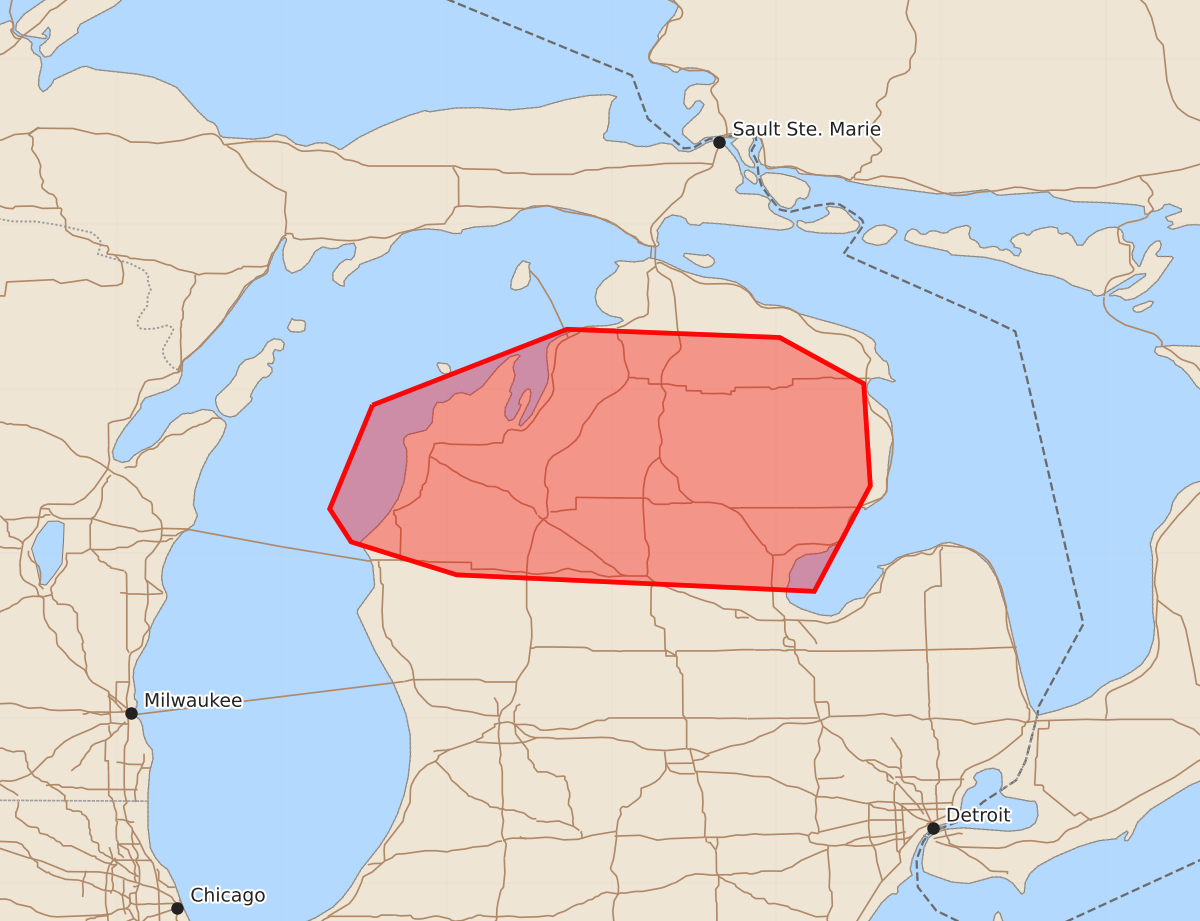
Summary
Strong to severe storms capable of producing damaging winds and isolated hail are possible across northern Lower Michigan overnight. The most likely threats include wind gusts of 55 to 70 mph and hail up to 1.25 inches.
Product Text
000 ACUS11 KWNS 020539 SWOMCD SPC MCD 020538 MIZ000-020745- Mesoscale Discussion 1434 NWS Storm Prediction Center Norman OK 1238 AM CDT Thu Jul 02 2026 Areas affected...Northern Lower MI Concerning...Severe potential...Watch possible Valid 020538Z - 020745Z Probability of Watch Issuance...40 percent SUMMARY...Strong to locally severe storms remain possible overnight. DISCUSSION...Strong storms over northern Lake Michigan are moving into northwest Lower MI as of 0535 UTC. This portion of Lower MI is generally north of remnant outflow, with temperatures in the upper 60s to around 70 F (compared to around 80 F south of the boundary). However, relatively rich low-level moisture is helping to maintain MUCAPE of near/above 2000 J/kg early this morning, with moderate deep-layer flow/shear (observed on the KAPX VWP) supporting some organized-storm potential. The small storm cluster approaching northwest Lower MI may persist into at least north-central Lower MI overnight. Damaging-wind potential will accompany this cluster, though near-surface stability may mitigate this threat to some extent. Other discrete convection developing in advance of this cluster could pose a threat of localized wind damage and isolated hail, if these storms are able to mature. Given the somewhat elevated nature of ongoing convection, the magnitude of the wind threat is uncertain, but trends will be monitored for increasing wind-damage potential and possible watch issuance. ..Dean/Smith.. 07/02/2026 ...Please see www.spc.noaa.gov for graphic product... ATTN...WFO...DTX...APX...GRR... LAT...LON 44908645 45368527 45318398 45038347 44418343 43778377 43878594 44078658 44278671 44908645 MOST PROBABLE PEAK WIND GUST...55-70 MPH MOST PROBABLE PEAK HAIL SIZE...UP TO 1.25 IN