Mesoscale Discussion 1240
Issued: · Valid: –
Summary
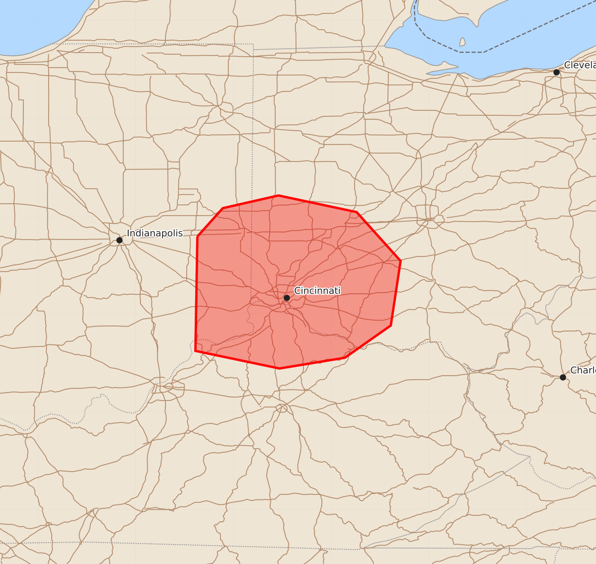
Severe thunderstorms capable of producing damaging winds and tornadoes are expected to move into far eastern Indiana, northern Kentucky, and southwest Ohio this evening. These storms may bring wind gusts up to 70 mph and tornadoes with peak intensities between 85 and 110 mph.
Product Text
000 ACUS11 KWNS 220025 SWOMCD SPC MCD 220024 OHZ000-KYZ000-INZ000-220100- Mesoscale Discussion 1240 NWS Storm Prediction Center Norman OK 0724 PM CDT Sun Jun 21 2026 Areas affected...far eastern Indiana...portions of northern Kentucky...and southwest Ohio Concerning...Severe potential...Watch needed soon Valid 220024Z - 220100Z Probability of Watch Issuance...95 percent SUMMARY...A watch will be needed shortly for thunderstorms approaching the area. DISCUSSION...Ongoing severe thunderstorms across southern into central Indiana will move into the area in the next couple of hours. The overall environment will continue to support a severe threat into Ohio and parts of northern Kentucky, with damaging winds and perhaps a couple of tornadoes possible. A watch will be coordinated shortly. ..Marsh/Smith.. 06/22/2026 ...Please see www.spc.noaa.gov for graphic product... ATTN...WFO...ILN...LMK...IND... LAT...LON 39798537 40088511 40218454 40048374 39548329 38888339 38558386 38448453 38628539 39798537 MOST PROBABLE PEAK TORNADO INTENSITY...85-110 MPH MOST PROBABLE PEAK WIND GUST...55-70 MPH MOST PROBABLE PEAK HAIL SIZE...UP TO 1.25 IN