Mesoscale Discussion 1496
Issued: · Valid: –
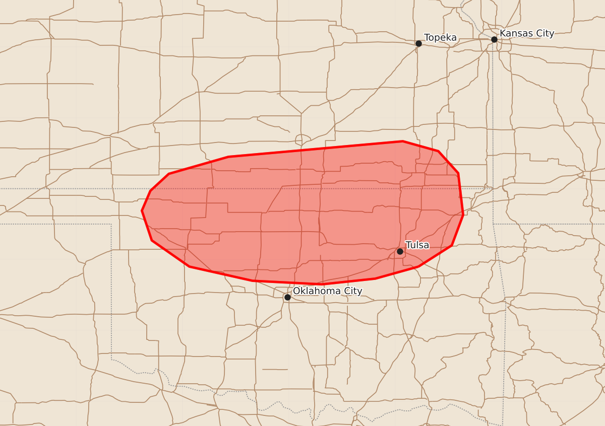
Summary
Severe thunderstorms capable of producing damaging wind gusts and large hail are expected to develop across parts of southern Kansas and northern Oklahoma this afternoon.
Product Text
000 ACUS11 KWNS 042050 SWOMCD SPC MCD 042049 OKZ000-KSZ000-042315- Mesoscale Discussion 1496 NWS Storm Prediction Center Norman OK 0349 PM CDT Sat Jul 04 2026 Areas affected...Parts of southern Kansas and northern Oklahoma Concerning...Severe potential...Watch likely Valid 042049Z - 042315Z Probability of Watch Issuance...95 percent SUMMARY...Severe thunderstorm development is expected between 22-00Z. The primary concerns will be severe wind gusts and large hail. DISCUSSION...The latest visible satellite imagery depicts an increasingly agitated boundary-layer cumulus field evolving at the nose of a robust heat axis extending into northwest OK. Additional deepening cumulus is evident along a remnant outflow boundary in south-central KS into northern OK. Over the next few hours, continued diurnal heating should promote thunderstorm development in these zones of mesoscale ascent. The pre-convective environment is characterized by a warm/moist PBL (lower 70s dewpoints) beneath steep midlevel lapse rates (sampled by the DDC 18Z sounding). The resultant strong surface-based buoyancy and around 40 kt of effective shear (with modest low-level hodograph curvature) will initially promote semi-discrete supercells capable of producing severe wind gusts and very large hail. While uncertain, a tornado cannot be entirely ruled out with any boundary/storm interactions. With time, increasing storm coverage and congealing cold pools should promote upscale growth into organized clusters, with an increasing risk for scattered severe/damaging gusts with southward extent. A watch is likely this afternoon. ..Weinman/Hart.. 07/04/2026 ...Please see www.spc.noaa.gov for graphic product... ATTN...WFO...TSA...ICT...OUN...DDC... LAT...LON 35909567 35739628 35659703 35709801 35909890 36279943 36699957 36979945 37219919 37459835 37679589 37539539 37229511 36639504 36209520 35909567 MOST PROBABLE PEAK TORNADO INTENSITY...UP TO 90 MPH MOST PROBABLE PEAK WIND GUST...65-80 MPH MOST PROBABLE PEAK HAIL SIZE...1.50-2.50 IN