Mesoscale Discussion 1147
Issued: · Valid: –
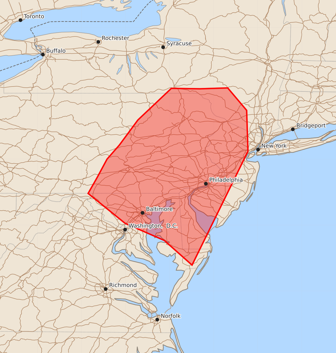
Summary
Severe thunderstorms capable of producing damaging winds, isolated hail, and a brief tornado are expected across parts of the Mid-Atlantic through late evening. This threat includes a line of storms moving through central Pennsylvania and developing supercells in southeastern Pennsylvania, Maryland, and northern Virginia that may spread into Delaware and New Jersey.
Product Text
000 ACUS11 KWNS 150126 SWOMCD SPC MCD 150125 NJZ000-NYZ000-PAZ000-MDZ000-DEZ000-150330- Mesoscale Discussion 1147 NWS Storm Prediction Center Norman OK 0825 PM CDT Sun Jun 14 2026 Areas affected...Parts of the Mid Atlantic Concerning...Severe Thunderstorm Watch 335...337... Valid 150125Z - 150330Z The severe weather threat for Severe Thunderstorm Watch 335, 337 continues. SUMMARY...A threat for strong to locally severe storms will continue into late evening. Damaging wind, isolated hail, and a brief tornado all remain possible. DISCUSSION...An increase in semi-discrete storms has recently been noted from southeast PA into MD and northern VA, with a supercell ongoing as of 0115Z south of Lancaster, PA. The 00Z IAD sounding depicted 45 kt of effective shear and MLCAPE in excess of 1000 J/kg, which will continue to support supercell potential with the strongest storms through the evening. Damaging wind, isolated hail, and perhaps a brief tornado could accompany any sustained supercell. This developing cluster of storms may eventually spread into parts of DE and NJ with a continued severe risk. Farther west, a line of storms associated with a cold front is moving eastward across central PA, with occasional wind-damage reports and observed gusts of generally 50-60 mph. This line may continue to pose a threat of wind damage in the short term as it moves eastward, though some continued weakening is expected with time later through the evening. ..Dean.. 06/15/2026 ...Please see www.spc.noaa.gov for graphic product... ATTN...WFO...OKX...ALY...PHI...BGM...AKQ...CTP...LWX... LAT...LON 40687422 38097549 38657612 39047701 39727785 40097764 40507742 40827714 41397672 42117596 42107531 42127468 41617425 40687422 MOST PROBABLE PEAK TORNADO INTENSITY...85-110 MPH MOST PROBABLE PEAK WIND GUST...55-70 MPH MOST PROBABLE PEAK HAIL SIZE...UP TO 1.25 IN