Mesoscale Discussion 1136
This product has been superseded. View the updated product →
Issued: · Valid: –
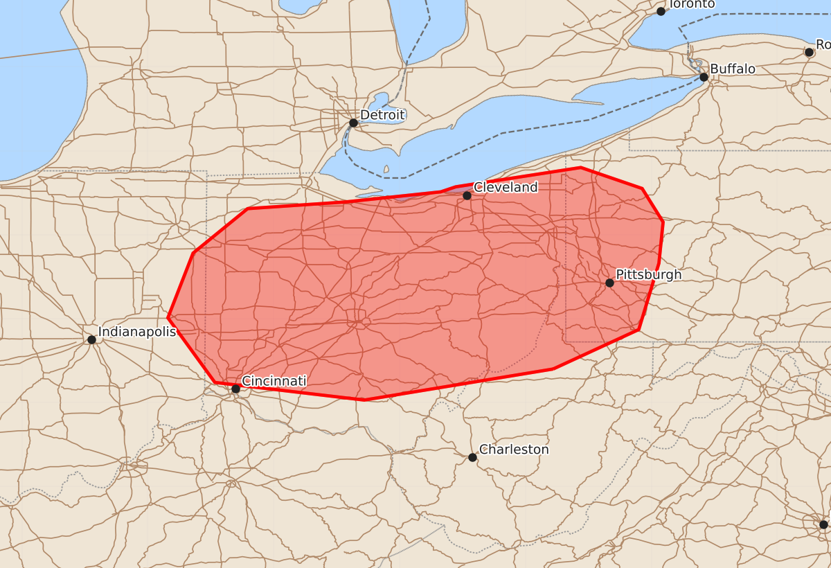
Summary
Increasingly intense thunderstorms are expected to move through eastern Indiana, western Ohio, western Pennsylvania, and the northern West Virginia panhandle this afternoon. These storms may produce damaging winds, hail, and possible tornadoes.
Product Text
000 ACUS11 KWNS 141649 SWOMCD SPC MCD 141649 PAZ000-WVZ000-OHZ000-INZ000-141745- Mesoscale Discussion 1136 NWS Storm Prediction Center Norman OK 1149 AM CDT Sun Jun 14 2026 Areas affected...far eastern Indiana...portions of Ohio...western Pennsylvania...northern West Virginia Panhandle Concerning...Severe potential...Watch likely Valid 141649Z - 141745Z Probability of Watch Issuance...80 percent SUMMARY...Thunderstorm activity along and ahead the cold front will continue to increase in coverage and intensity. Severe potential will increase into the afternoon. DISCUSSION...Thunderstorm activity ongoing along the cold front from central Indiana into western Ohio is increasing in coverage and intensity. Ahead of the front, filtered daytime heating has warmed temperatures in Ohio into the mid to upper 80s. This in combination with dew points in the upper 60s to 70s has yielded MLCAPE around 500-1000 J/kg. Low-level lapse rates are also steepening, with around 7-7.5 C/km analyzed in SPC Mesoanalysis. Increasingly favorable thermodynamics in combination with deep layer shear around 45-50 kts will support storm organization and severe potential downstream. Increasingly favorable low-level shear profiles into PA, where surface winds have more of a southeasterly component may support potential for line embedded circulations and perhaps a tornado. The main hazard will be damaging wind. A watch will will be needed soon to cover this potential severe risk. ..Thornton/Mosier.. 06/14/2026 ...Please see www.spc.noaa.gov for graphic product... ATTN...WFO...PBZ...RLX...CLE...ILN...IWX...IND... LAT...LON 39408067 39038292 39248470 40018526 40788496 41318431 41398314 41518201 41578183 41808034 41557961 41157936 40667941 39877965 39408067 MOST PROBABLE PEAK TORNADO INTENSITY...UP TO 90 MPH MOST PROBABLE PEAK WIND GUST...55-70 MPH MOST PROBABLE PEAK HAIL SIZE...UP TO 1.25 IN