Mesoscale Discussion 2330
Issued: · Valid: –
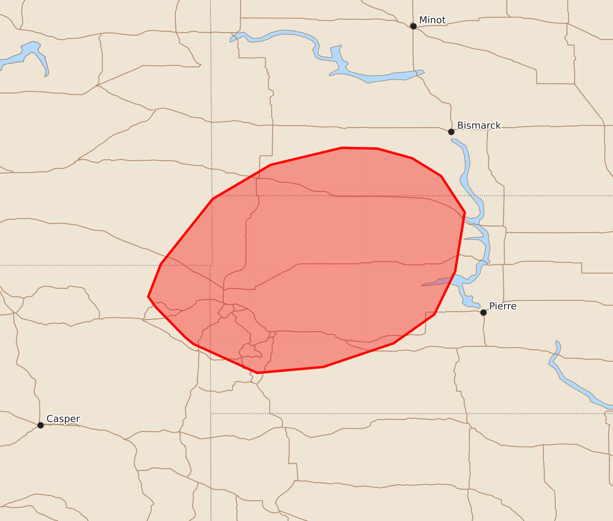
Summary
Isolated strong to severe thunderstorms may produce sporadic hail across western South Dakota through the evening. The severe potential for these storms is expected to remain limited.
Product Text
000 ACUS11 KWNS 281941 SWOMCD SPC MCD 281940 SDZ000-NDZ000-MTZ000-WYZ000-282145- Mesoscale Discussion 2330 NWS Storm Prediction Center Norman OK 0240 PM CDT Mon Sep 28 2026 Areas affected...western South Dakota vicinity Concerning...Severe potential...Watch unlikely Valid 281940Z - 282145Z Probability of Watch Issuance...5 percent SUMMARY...Isolated strong to severe thunderstorms may produce sporadic hail through evening. Severe potential is expected to remain limited, and a watch is not anticipated. DISCUSSION...Thunderstorms are developing near the Black Hills across northeast WY this afternoon. This activity is developing near the surface low and attendant cold front within an area that has seen less cloudiness/stronger heating. An area of cumulus development is noted in visible satellite imagery where clearing has been more prevalent across northwest SD into southwest ND. Additional thunderstorm development is expected within this area over the next few hours. Latest mesoanalysis shows MLCAPE around 1000-1500 J/kg and 7-7.5 C/km midlevel lapse rates across the region, which aligns well with 18z RAOBS from UNR and BIS. Effective shear magnitudes around 30 kt and elongated hodographs above 2 km in combination with this thermodynamic environment suggests that a few organized updrafts could support marginally severe hail. With time, and northeast extent, convection may become more elevated given greater low-level inhibition where cloudiness has persisted, and as the cold front begins to surge east/southeast during the evening. ..Leitman/Gleason.. 09/28/2026 ...Please see www.spc.noaa.gov for graphic product... ATTN...WFO...ABR...BIS...UNR...BYZ... LAT...LON 43940426 44030437 44440477 44580487 45020470 45900400 46360322 46590226 46580178 46450131 46210092 45720060 44920073 44340101 43950156 43630251 43550340 43940426 MOST PROBABLE PEAK WIND GUST...UP TO 60 MPH MOST PROBABLE PEAK HAIL SIZE...UP TO 1.25 IN