Watch 407 Outline
Issued:
Summary
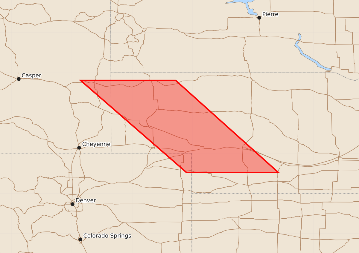
A severe thunderstorm watch is in effect for central Nebraska, including Scottsbluff and North Platte, from late evening through early tomorrow morning. Expected hazards include large hail up to 2.5 inches and wind gusts of 70 knots.
Product Text
000 WWUS30 KWNS 272112 SAW7 SPC AWW 272112 WW 407 SEVERE TSTM CO NE 272115Z - 280500Z AXIS..60 STATUTE MILES EAST AND WEST OF LINE.. 65N BFF/SCOTTSBLUFF NE/ - 45SSW LBF/NORTH PLATTE NE/ ..AVIATION COORDS.. 50NM E/W /56N BFF - 27NW MCK/ HAIL SURFACE AND ALOFT..2.5 INCHES. WIND GUSTS..70 KNOTS. MAX TOPS TO 550. MEAN STORM MOTION VECTOR 25025. LAT...LON 42810242 40529987 40520215 42810478 THIS IS AN APPROXIMATION TO THE WATCH AREA. FOR A COMPLETE DEPICTION OF THE WATCH SEE WOUS64 KWNS FOR WOU7.