Mesoscale Discussion 2277
Issued: · Valid: –
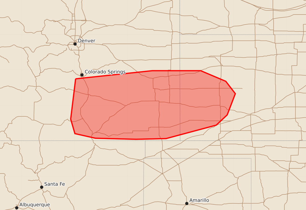
Summary
Sporadic severe thunderstorms capable of producing hail and damaging wind gusts are possible for portions of southeastern Colorado and southwest Kansas over the next few hours.
Product Text
000 ACUS11 KWNS 100544 SWOMCD SPC MCD 100543 KSZ000-COZ000-100745- Mesoscale Discussion 2277 NWS Storm Prediction Center Norman OK 1243 AM CDT Thu Sep 10 2026 Areas affected...portions of southeastern Colorado and southwest Kansas Concerning...Severe potential...Watch unlikely Valid 100543Z - 100745Z Probability of Watch Issuance...5 percent SUMMARY...Sporadic hail and damaging gusts are possible for a few hours tonight with scattered strong storms. DISCUSSION...Numerous thunderstorms have developed this evening within a post-frontal upslope flow regime across southeastern CO and western KS. Continued weak ascent and moderate buoyancy aloft will likely support numerous updrafts, including some stronger ones through tonight. Deep-layer shear is supportive of occasional/transient organization with splitting supercells already observed. This will support some potential for sporadic severe hail with the stronger storms over the next few hours. Damaging wind potential is more uncertain given the boundary layer is likely somewhat stable and should become more stable with time. However, some potential may exist as storms cluster and occasional stronger downdrafts develop. So far the stronger/organized storms have been more transient in nature. Short term guidance does show storms persisting through the overnight with some clustering as they move into southwest KS. While sporadic severe potential is evident, the environment should become more stable and should limit the severe risk with time. Given the limited potential for organization and then environment becoming less favorable with time a WW is unlikely. ..Lyons/Mosier.. 09/10/2026 ...Please see www.spc.noaa.gov for graphic product... ATTN...WFO...DDC...GLD...PUB...BOU... LAT...LON 38750497 38980280 38980143 38680072 38330045 37730068 37440099 37060241 37040326 37070441 37200499 37610511 38750497 MOST PROBABLE PEAK WIND GUST...55-70 MPH MOST PROBABLE PEAK HAIL SIZE...1.00-1.75 IN