Mesoscale Discussion 1228
Issued: · Valid: –
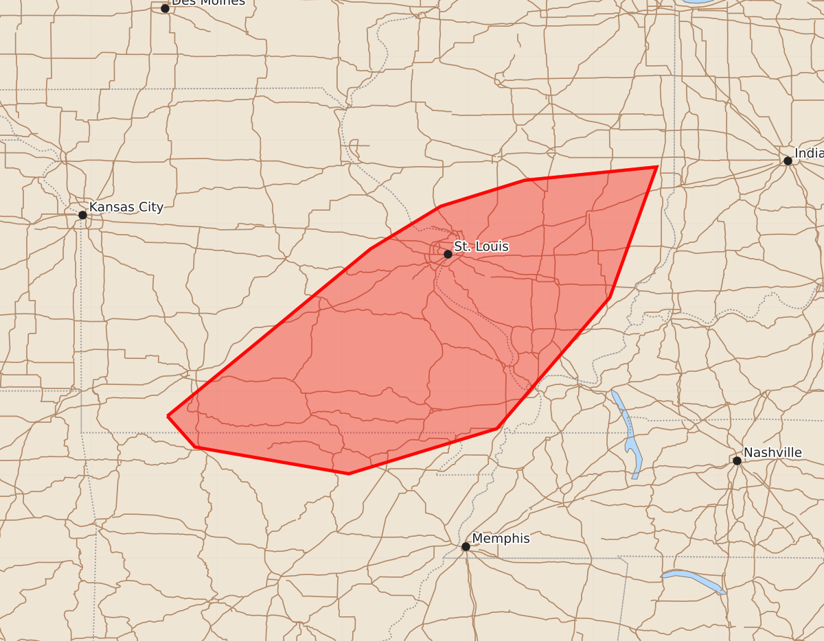
Summary
Thunderstorms in southern Illinois, southeastern Missouri, and northern Arkansas may intensify through early afternoon, bringing a risk of tornadoes and strong wind gusts. Severe weather potential is increasing during this period.
Product Text
000 ACUS11 KWNS 211507 SWOMCD SPC MCD 211506 ILZ000-MOZ000-ARZ000-211700- Mesoscale Discussion 1228 NWS Storm Prediction Center Norman OK 1006 AM CDT Sun Jun 21 2026 Areas affected...southern Illinois...much of southeastern Missouri...adjacent northern Arkansas Concerning...Severe potential...Watch possible Valid 211506Z - 211700Z Probability of Watch Issuance...40 percent SUMMARY...Thunderstorm development may slowly intensify through early afternoon, accompanied by increasing strong to severe wind gusts and a risk for tornadoes. A severe weather watch will probably be needed at some point, though how soon remains uncertain. DISCUSSION...Convective development persists with a pair of remnant mesoscale convective vortices migrating eastward, within the leading edge of weak larger-scale mid-level troughing spreading across the lower Missouri/middle Mississippi Valley region. One vortex remains a bit better defined and is in the process of migrating across northeastern Missouri into west central Illinois. The other appears to be slowly migrating eastward to the north of Springfield, MO. A belt of 30+ kt deep-layer southwesterly mean flow is accompanying these perturbation, and appears to include wind speeds on the order of 30-50 kt in the 850-500 mb layer. Associated shear likely has been contributing to the occasional evolution of meso-gamma scale circulations along the gust front of otherwise still modest thunderstorm development now advancing into/across the I-44 corridor of southwestern Missouri. However, low-level moistening and boundary-layer warming along and north of a weakening frontal zone extending eastward ahead of activity are contributing to substantive boundary layer destabilization across southeastern Missouri, as far north as the Greater St. Louis area, into the lower Ohio Valley. As this proceeds, and develops further northward through portions of central Illinois during the next few hours, increasing unstable updraft inflow probably will contribute to at least a gradual intensification of storms with increasing severe weather potential. This may include developing cyclonic circulations with potential to produce strong to severe surface gusts and the risk for tornadoes. ..Kerr/Hart.. 06/21/2026 ...Please see www.spc.noaa.gov for graphic product... ATTN...WFO...PAH...ILX...MEG...LSX...LZK...SGF...TSA... LAT...LON 36709359 37529259 38199178 38709116 39219032 39528932 39688774 38128830 36558965 36019142 36339326 36709359 MOST PROBABLE PEAK TORNADO INTENSITY...85-110 MPH MOST PROBABLE PEAK WIND GUST...55-70 MPH MOST PROBABLE PEAK HAIL SIZE...1.00-1.75 IN