Mesoscale Discussion 1294
Issued: · Valid: –
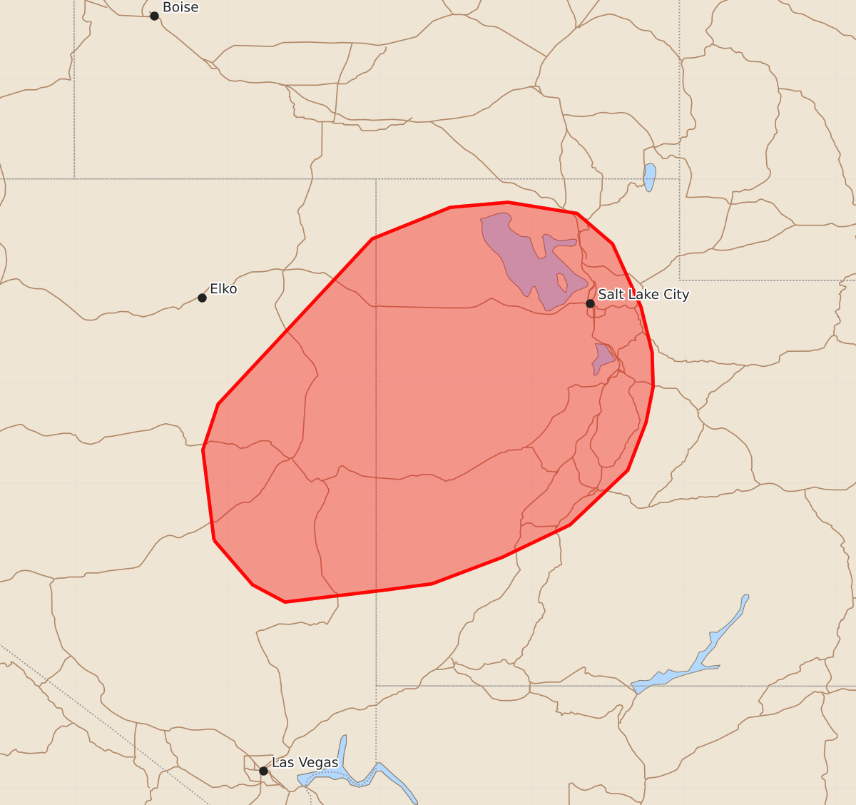
Summary
Severe downburst winds from developing thunderstorms may affect portions of the eastern Great Basin, including eastern Nevada and northwest Utah, through late afternoon. These storms could produce wind gusts as high as 75 mph.
Product Text
000 ACUS11 KWNS 241913 SWOMCD SPC MCD 241912 UTZ000-NVZ000-242115- Mesoscale Discussion 1294 NWS Storm Prediction Center Norman OK 0212 PM CDT Wed Jun 24 2026 Areas affected...Portions of the Great Basin Concerning...Severe potential...Watch possible Valid 241912Z - 242115Z Probability of Watch Issuance...60 percent SUMMARY...Thunderstorms developing across the eastern Great Basin region will pose a risk for severe downburst winds. Watch issuance is possible for portions of the region as thunderstorm coverage increases through late afternoon. DISCUSSION...Latest GOES imagery shows steady deepening of cumulus across eastern NV into UT as temperatures quickly warm into the low 90s. An 18 UTC RAOB from SLC sampled some lingering inhibition, but modifying the sounding based on regional surface observations suggests that inhibition should largely be removed as temperatures warm into the mid 90s. Wildfire smoke and high-level cirrus across central and eastern UT may mute diurnal warming to some degree, but portions of eastern NV/northwest UT will likely reach these temperatures within the next hour or so. As this occurs, thunderstorm initiation will become more probable, especially as ascent ahead of an approaching upper disturbance overspreads the region. Dry boundary-layer conditions observed in the sounding appear to be fairly widespread based on 45-50 F dewpoint depressions region-wide. These low-level thermodynamic profiles are favorable for accelerating downdrafts capable of producing strong to severe wind gusts, possibly as high as 75 mph (especially if more coherent, loosely organized clusters or bands can become established as hinted by some CAM solutions). Trends will continue to be monitored, and watch issuance may be needed as thunderstorm coverage begins to increase. ..Moore/Guyer.. 06/24/2026 ...Please see www.spc.noaa.gov for graphic product... ATTN...WFO...SLC...VEF...LKN... LAT...LON 38441564 39331575 39781560 41411408 41721331 41771274 41661206 41361171 40741143 40291132 39951131 39601138 39131156 38591213 38271280 38011349 37951394 37831494 38001526 38441564 MOST PROBABLE PEAK WIND GUST...65-80 MPH