Mesoscale Discussion 1513
Issued: · Valid: –
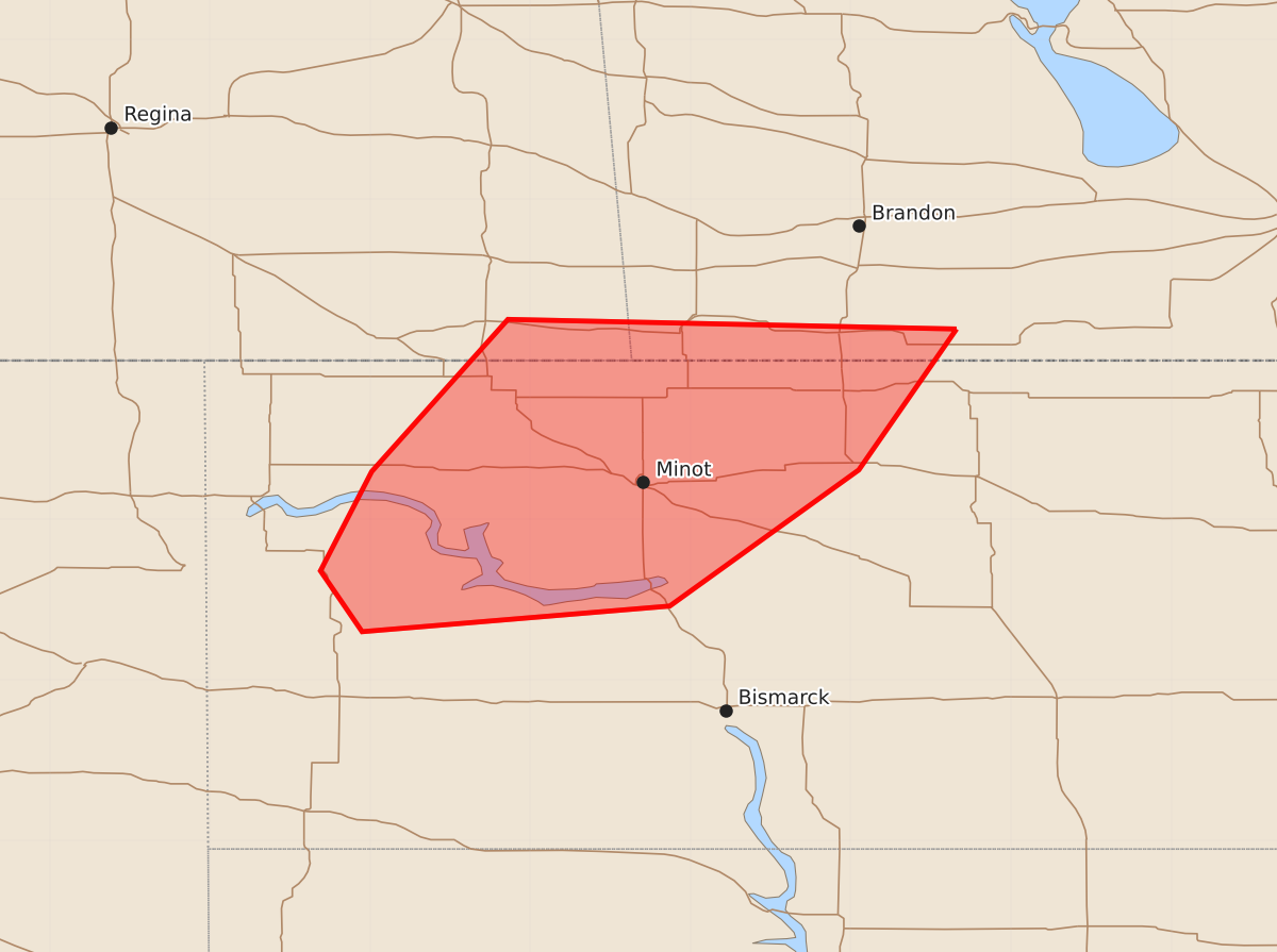
Summary
Isolated large hail and strong wind gusts are expected across portions of northern North Dakota starting this evening. These severe thunderstorms are forecast to occur through the night.
Product Text
000 ACUS11 KWNS 051948 SWOMCD SPC MCD 051947 NDZ000-052145- Mesoscale Discussion 1513 NWS Storm Prediction Center Norman OK 0247 PM CDT Sun Jul 05 2026 Areas affected...portions of northern North Dakota Concerning...Severe potential...Watch likely Valid 051947Z - 052145Z Probability of Watch Issuance...80 percent SUMMARY...Thunderstorm development is expected by 22z. Isolated large hail and strong wind gusts will be the main hazards with these storms through evening. A severe thunderstorm watch will likely be needed in the next 1-2 hours. DISCUSSION...Mostly clear skies have allowed for strong heating in the upper 80 to low 90s across western/central ND. Boundary layer moisture remains modest across the region, though a plume of 60s dewpoints has spread north and west across portions of the discussion area ahead of a surface cold front over the Canadian Prairies into northeast MT. Steepening midlevel lapse rates are supporting moderate destabilization, while increasing mid/upper southwesterly flow is resulting in 30-40 kt effective shear. Cumulus development is noted across western ND and thunderstorm initiation is expected in the next couple of hours. Supercell wind profiles are present across the region, and isolated large hail and strong wind gusts are expected with this activity. Trends are being monitored and a severe thunderstorm watch will likely be needed in the next couple hours. ..Leitman/Hart.. 07/05/2026 ...Please see www.spc.noaa.gov for graphic product... ATTN...WFO...FGF...BIS... LAT...LON 49199934 48319995 47460113 47300305 47680331 48300299 49250214 49199934 MOST PROBABLE PEAK WIND GUST...UP TO 60 MPH MOST PROBABLE PEAK HAIL SIZE...1.00-1.75 IN