Mesoscale Discussion 1311
Issued: · Valid: –
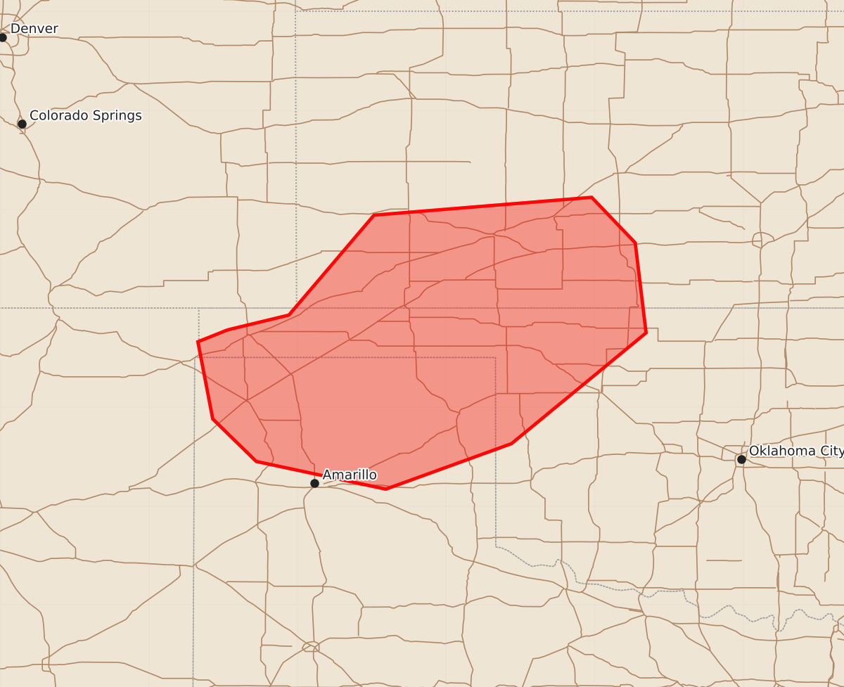
Summary
Severe storms capable of producing large hail, damaging winds, and a localized risk of tornadoes may develop across southwest Kansas, the Oklahoma Panhandle, northwest Oklahoma, and the northern Texas Panhandle by late afternoon. The most intense threats are expected to materialize between 3:00 PM and 4:30 PM CDT.
Product Text
000 ACUS11 KWNS 251856 SWOMCD SPC MCD 251856 OKZ000-KSZ000-TXZ000-NMZ000-252130- Mesoscale Discussion 1311 NWS Storm Prediction Center Norman OK 0156 PM CDT Thu Jun 25 2026 Areas affected...southwest Kansas...the Oklahoma Panhandle and northwest Oklahoma...and the northern Texas Panhandle Concerning...Severe potential...Watch possible Valid 251856Z - 252130Z Probability of Watch Issuance...60 percent SUMMARY...The potential for severe storms capable of mainly large hail and damaging winds is expected to increase across the discussion area by 20-21Z. A localized corridor of tornado potential may materialize at that time in southwest Kansas into northwest OK, generally along and east of US 283. DISCUSSION...Recent trends in visible satellite indicate a deepening cumulus field over the central OK Panhandle, near Guymon. Mesoanalysis places that convection near a surface low, which is located along a front extending from southwest KS into the western Oklahoma Panhandle. That boundary delineates a hot, deeper-mixed boundary layer to the south across the northern TX Panhandle from a more moist and unstable air mass to the north in southwest KS. Continued daytime heating and resultant air mass destabilization should eventually support isolated to widely scattered, high-based thunderstorms across the western 2/3rds of the OK and far northern TX Panhandles, near and to the immediate south of the frontal segment west of the surface low. The potential for strong evaporative cooling within the sub-cloud layer will support severe wind gusts as the primary hazard with large hail also possible. Additional storms are anticipated from the vicinity of the surface low east along the frontal segment in southwest KS and northwest OK. That environment features a considerably more moist/low LCL boundary, which coincides with a zone of enhanced low-level and deep-layer shear, supportive of supercell storm modes capable of large hail and perhaps a few tornadoes, especially along and east of US 283. Convective trends are being monitored in both regimes for a possible watch. ..Mead.. 06/25/2026 ...Please see www.spc.noaa.gov for graphic product... ATTN...WFO...OUN...DDC...AMA...ABQ... LAT...LON 36780271 36930209 37940123 38129903 37669859 36759848 35639984 35170111 35450242 35880286 36660301 36780271 MOST PROBABLE PEAK TORNADO INTENSITY...100-125 MPH MOST PROBABLE PEAK WIND GUST...55-70 MPH MOST PROBABLE PEAK HAIL SIZE...1.50-2.50 IN