Mesoscale Discussion 1322
Issued: · Valid: –
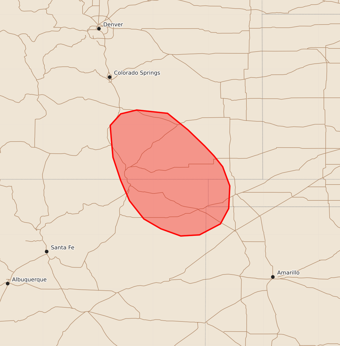
Summary
Isolated strong to severe thunderstorms capable of producing large hail and damaging wind gusts are expected across portions of southeastern Colorado, northeastern New Mexico, and the western Texas and Oklahoma Panhandles through early evening.
Product Text
000 ACUS11 KWNS 252341 SWOMCD SPC MCD 252340 OKZ000-COZ000-TXZ000-NMZ000-260115- Mesoscale Discussion 1322 NWS Storm Prediction Center Norman OK 0640 PM CDT Thu Jun 25 2026 Areas affected...portions of southeastern Colorado and northeastern New Mexico into the western Texas/Oklahoma Panhandles Concerning...Severe potential...Watch possible Valid 252340Z - 260115Z Probability of Watch Issuance...40 percent SUMMARY...Isolated strong to severe thunderstorms will pose a threat for occasional large hail and damaging wind gusts. DISCUSSION...Isolated supercells have developed along the high terrain areas and along a southward-progressing cold front from southeastern Colorado into northeastern New Mexico. Strong effective shear (40-50+ kts) and MUCAPE of 500-1500 J/kg will continue to support supercell structures, with elongated hodographs and mid-level lapse rates of 8+ C/km supporting a risk for isolated large hail. Steep low-level lapse rates will also promote a risk for occasional damaging wind gusts. Increasing low-level stability/CIN amid low-level cold air advection behind the cold front lends uncertainty to longevity/persistence of these cells as they move off of the high terrain. Given this, watch issuance remains uncertain. ..Chalmers/Mosier.. 06/25/2026 ...Please see www.spc.noaa.gov for graphic product... ATTN...WFO...AMA...PUB...ABQ... LAT...LON 37430290 37230274 36880261 36470263 36190278 35990316 35970350 36100386 36280417 36610443 36980459 37400473 37730476 37980478 38190459 38260430 38200374 37900337 37610307 37430290 MOST PROBABLE PEAK TORNADO INTENSITY...UP TO 90 MPH MOST PROBABLE PEAK WIND GUST...55-70 MPH MOST PROBABLE PEAK HAIL SIZE...1.00-1.75 IN