Mesoscale Discussion 1317
Issued: · Valid: –
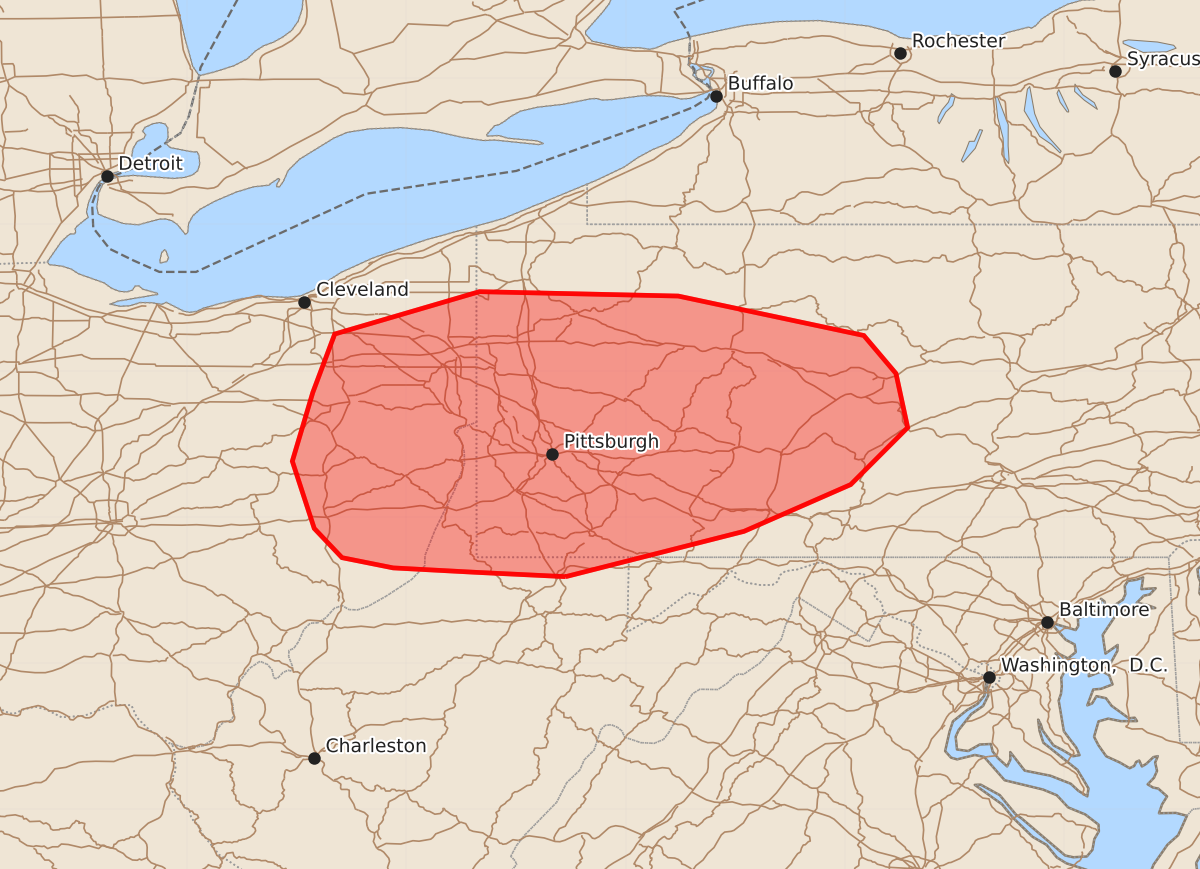
Summary
Widely scattered supercells bringing isolated wind damage, large hail, and a few brief tornadoes are expected across eastern Ohio and western Pennsylvania through early evening.
Product Text
000 ACUS11 KWNS 252153 SWOMCD SPC MCD 252152 PAZ000-MDZ000-WVZ000-OHZ000-252215- Mesoscale Discussion 1317 NWS Storm Prediction Center Norman OK 0452 PM CDT Thu Jun 25 2026 Areas affected...Eastern Ohio and western Pennsylvania Concerning...Severe potential...Watch needed soon Valid 252152Z - 252215Z Probability of Watch Issuance...95 percent SUMMARY...Widely scattered supercells with isolated wind damage, large hail and a brief tornado or two will be possible through about 01z. A severe thunderstorm watch is being issued soon. DISCUSSION...In tandem with a pronounced midlevel trough crossing the OH Valley, widely scattered thunderstorms have formed in a moderately unstable and uncapped warm sector from eastern OH into western/central PA. Local VWPs show relatively straight hodographs with sufficient length for sustained supercells, and buoyancy should remain sufficient for severe storms for the next few hours where boundary-layer dewpoints are in the 60s. Any tornado threat will likely be tied to local terrain influences and/or favorable storm interactions. Thereafter, cooling surface temperatures and gradual stabilization should begin to lessen the threat. A severe thunderstorm watch is being coordinated now with local NWS offices to reflect the severe-storm threat into this evening. ..Thompson/Mosier.. 06/25/2026 ...Please see www.spc.noaa.gov for graphic product... ATTN...WFO...CTP...LWX...PBZ...CLE... LAT...LON 39597991 39628053 39658109 39728144 39928163 40388178 40858164 41258149 41548050 41517914 41247787 40987765 40617757 40227796 39907869 39597991 MOST PROBABLE PEAK TORNADO INTENSITY...UP TO 90 MPH MOST PROBABLE PEAK WIND GUST...55-70 MPH MOST PROBABLE PEAK HAIL SIZE...1.00-1.75 IN