Mesoscale Discussion 1633
Issued: · Valid: –
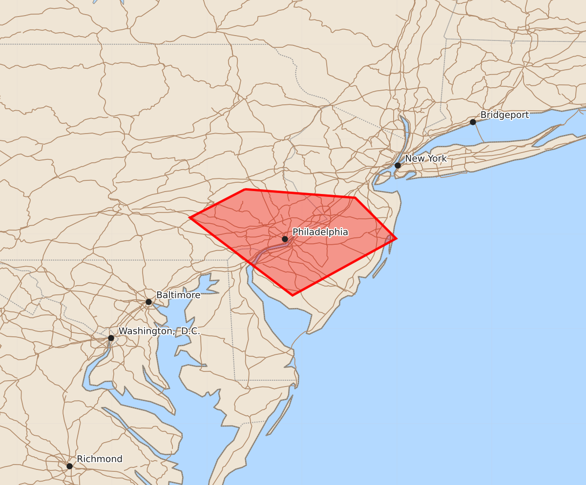
Summary
Isolated strong thunderstorms are expected to develop across southeastern Pennsylvania and southern New Jersey through 5-7 PM EDT. These storms may produce large hail and strong wind downbursts.
Product Text
000 ACUS11 KWNS 162000 SWOMCD SPC MCD 161959 NJZ000-PAZ000-DEZ000-162200- Mesoscale Discussion 1633 NWS Storm Prediction Center Norman OK 0259 PM CDT Thu Jul 16 2026 Areas affected...parts of southeastern Pennsylvania...southern New Jersey Concerning...Severe potential...Watch unlikely Valid 161959Z - 162200Z Probability of Watch Issuance...20 percent SUMMARY...The initiation of strong thunderstorm development appears underway near and north through northeast of the Philadelphia area, with further intensification probable through 5-7 PM EDT. Though stronger storm development may remain relative isolated in nature, it could be accompanied by large hail and a couple of strong downbursts. It is not clear that this requires a severe weather watch, but trends are being monitored. DISCUSSION...Convergence within weak surface troughing across the northern Mid Atlantic coast vicinity appears weak, but has been sufficient to support a corridor of slowly deepening convective development to the north through northeast of the Philadelphia area the past few hours. As a weak surface cold front slowly advances across this vicinity during the next couple of hours, the initiation of thunderstorm activity appears increasingly probable. This may remain relatively isolated, but could include the evolution of an isolated supercell structure or two, aided by updraft inflow emanating from a strongly heated boundary-layer with seasonably high moisture content. Beneath modestly steep mid-level lapse and 40-50 kt westerly flow in the 700-500 mb layer, profiles appear to conducive the risk for large hail and a couple of strong downbursts, before storms spread with more favorable large-scale forcing offshore by early evening. ..Kerr/Guyer.. 07/16/2026 ...Please see www.spc.noaa.gov for graphic product... ATTN...WFO...PHI...CTP... LAT...LON 40477560 40387444 39957401 39357510 40177618 40477560 MOST PROBABLE PEAK TORNADO INTENSITY...UP TO 90 MPH MOST PROBABLE PEAK WIND GUST...55-70 MPH MOST PROBABLE PEAK HAIL SIZE...1.50-2.50 IN