Mesoscale Discussion 2091
Issued: · Valid: –
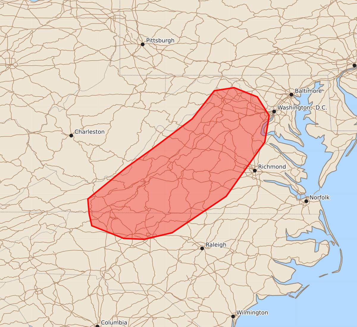
Summary
Thunderstorms capable of producing damaging wind gusts are expected to increase in coverage and spread eastward across western and central Virginia and northern North Carolina through this evening.
Product Text
000 ACUS11 KWNS 222202 SWOMCD SPC MCD 222202 MDZ000-VAZ000-WVZ000-NCZ000-230030- Mesoscale Discussion 2091 NWS Storm Prediction Center Norman OK 0502 PM CDT Sat Aug 22 2026 Areas affected...Portions of western/central Virginia and northern North Carolina Concerning...Severe potential...Watch possible Valid 222202Z - 230030Z Probability of Watch Issuance...40 percent SUMMARY...Storms are expected to increase in coverage while spreading eastward into this evening. The primary concern is locally damaging wind gusts. While a watch is not currently expected, trends are being monitored. DISCUSSION...Thunderstorms are increasing in coverage along the Blue Ridge in western VA, potentially aided by increasing midlevel height falls preceding a broad midlevel trough approaching the region from the west. Over the next few hours, these storms should continue spreading eastward across western/central VA and northern NC. A warm, moist, and uncapped air mass downstream should support a modest increase in thunderstorm coverage. While midlevel lapse rates are limiting overall buoyancy (around 1000-1500 J/kg MLCAPE), an elongated midlevel hodograph (40 kt of 0-6 km shear per FCX VWP) could promote a few loosely organized clusters capable of producing locally damaging wind gusts. While the overall risk may remain too localized/sparse for a watch, trends are being monitored. ..Weinman/Thompson.. 08/22/2026 ...Please see www.spc.noaa.gov for graphic product... ATTN...WFO...AKQ...LWX...RAH...RNK...GSP... LAT...LON 36568122 36908125 37628037 38057977 38737887 39377837 39447792 39237739 38807712 38207722 36967810 36137933 35987997 36008043 36298116 36568122 MOST PROBABLE PEAK WIND GUST...55-70 MPH MOST PROBABLE PEAK HAIL SIZE...UP TO 1.25 IN