Mesoscale Discussion 1309
Issued: · Valid: –
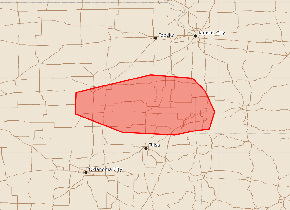
Summary
Severe storm potential is increasing across southeast and south-central Kansas, northeast and north-central Oklahoma, and southwest Missouri this afternoon. These storms may produce all severe hazards, including strong tornadoes, damaging winds, and large hail.
Product Text
000 ACUS11 KWNS 251739 SWOMCD SPC MCD 251738 MOZ000-OKZ000-KSZ000-252015- Mesoscale Discussion 1309 NWS Storm Prediction Center Norman OK 1238 PM CDT Thu Jun 25 2026 Areas affected...south-central and southeast Kansas...north-central and northeast Oklahoma...and southwest Missouri Concerning...Severe potential...Watch possible Valid 251738Z - 252015Z Probability of Watch Issuance...60 percent SUMMARY...The threat for severe storms capable of all hazards is expected to increase across the discussion area this afternoon. Convective trends are being monitored for a possible watch. DISCUSSION...As of 1730Z, mosaic radar data indicated a long-lived, bowing line segment west of Wichita with additional more cellular storms extending into north-central OK, east of Ponca City. That activity is likely still slightly elevated above a stable, near-surface inversion with the primary forcing mechanism being a zone of warm thermal and moisture advection occurring along a 30 kt low-level jet. Visible satellite indicates breaks in the cirrus cloud canopy across northern OK, which should allow for pockets of stronger heating to occur. And while mid-level lapse rates are not particularly steep, the presence of a very moist boundary layer will combine with the increased insolation to support MLCAPE of 1500-3000 J/kg with weakening MLCIN for surface-based parcels. The destabilization process coupled with the persistent warm advection is expected to promote the gradual intensification of the ongoing storms this afternoon with additional storm development possible along the synoptic front and/or any lingering outflow/differential heating boundaries. The combination of 40-45 kt westerly mid-level flow attending a subtle short-wave trough over central KS and the low-level jet mentioned above is resulting in a favorable kinematic environment for severe storms with the KVNX currently sampling 0-6-km shear and 0-1-km SRH of 54 kt and 200+ m2/s2, respectively. Given the above considerations, the potential for all severe-weather hazards is expected to increase this afternoon with any storms that can become rooted within the boundary layer. The greatest potential for a strong tornado or two will exist with supercell storm modes within this convective regime. Convective trends are being monitored for signs that storms are becoming surface-based, which would necessitate strong consideration for a watch. ..Mead.. 06/25/2026 ...Please see www.spc.noaa.gov for graphic product... ATTN...WFO...SGF...TSA...TOP...ICT...OUN... LAT...LON 37609778 37729729 38079580 37989469 37659436 37099410 36639424 36579468 36479516 36549655 37039780 37609778 MOST PROBABLE PEAK TORNADO INTENSITY...100-125 MPH MOST PROBABLE PEAK WIND GUST...55-70 MPH MOST PROBABLE PEAK HAIL SIZE...1.00-1.75 IN