Mesoscale Discussion 1932
Issued: · Valid: –
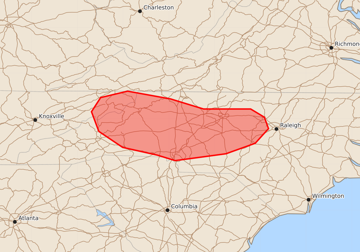
Summary
Isolated damaging wind gusts and marginally severe hail are possible across portions of northeastern Tennessee and western to central North Carolina through the late afternoon. These scattered thunderstorms are expected to produce wind gusts up to 60 mph and hail up to 1.25 inches.
Product Text
000 ACUS11 KWNS 112042 SWOMCD SPC MCD 112042 NCZ000-SCZ000-VAZ000-TNZ000-112245- Mesoscale Discussion 1932 NWS Storm Prediction Center Norman OK 0342 PM CDT Tue Aug 11 2026 Areas affected...portions of far northeastern Tennessee into western and central North Carolina Concerning...Severe potential...Watch unlikely Valid 112042Z - 112245Z Probability of Watch Issuance...5 percent SUMMARY...Potential continues for isolated damaging wind gusts and marginally severe hail. Watch issuance is not anticipated. DISCUSSION...Widely scattered to scattered thunderstorms remain ongoing along and south of a differential heating boundary/remnant outflow from northeastern Tennessee into western/central North Carolina. Weak effective shear (20 kts or less per latest objective analysis) is largely limiting storm organization, but 2500-3000 J/kg MLCAPE, modestly steep low-level lapse rates, and around 1.75" PW continue to support water loaded downbursts capable of producing isolated damaging wind gusts. Isolated instances of marginally severe hail have also been reported with the most robust cores within a zone of marginally steeper mid-level lapse rates (near 7 C/km). This potential is expected to continue for at least another 1-2 hours; however, watch issuance remains unlikely owing to the weak effective shear and resultant pulse-severe storm mode. ..Chalmers/Hart.. 08/11/2026 ...Please see www.spc.noaa.gov for graphic product... ATTN...WFO...RAH...RNK...GSP...MRX... LAT...LON 35208125 35378201 35728253 36158269 36468249 36608190 36438096 36218024 36217975 36217921 36037891 35787882 35467911 35237975 35088086 35208125 MOST PROBABLE PEAK WIND GUST...UP TO 60 MPH MOST PROBABLE PEAK HAIL SIZE...UP TO 1.25 IN