Mesoscale Discussion 1708
Issued: · Valid: –
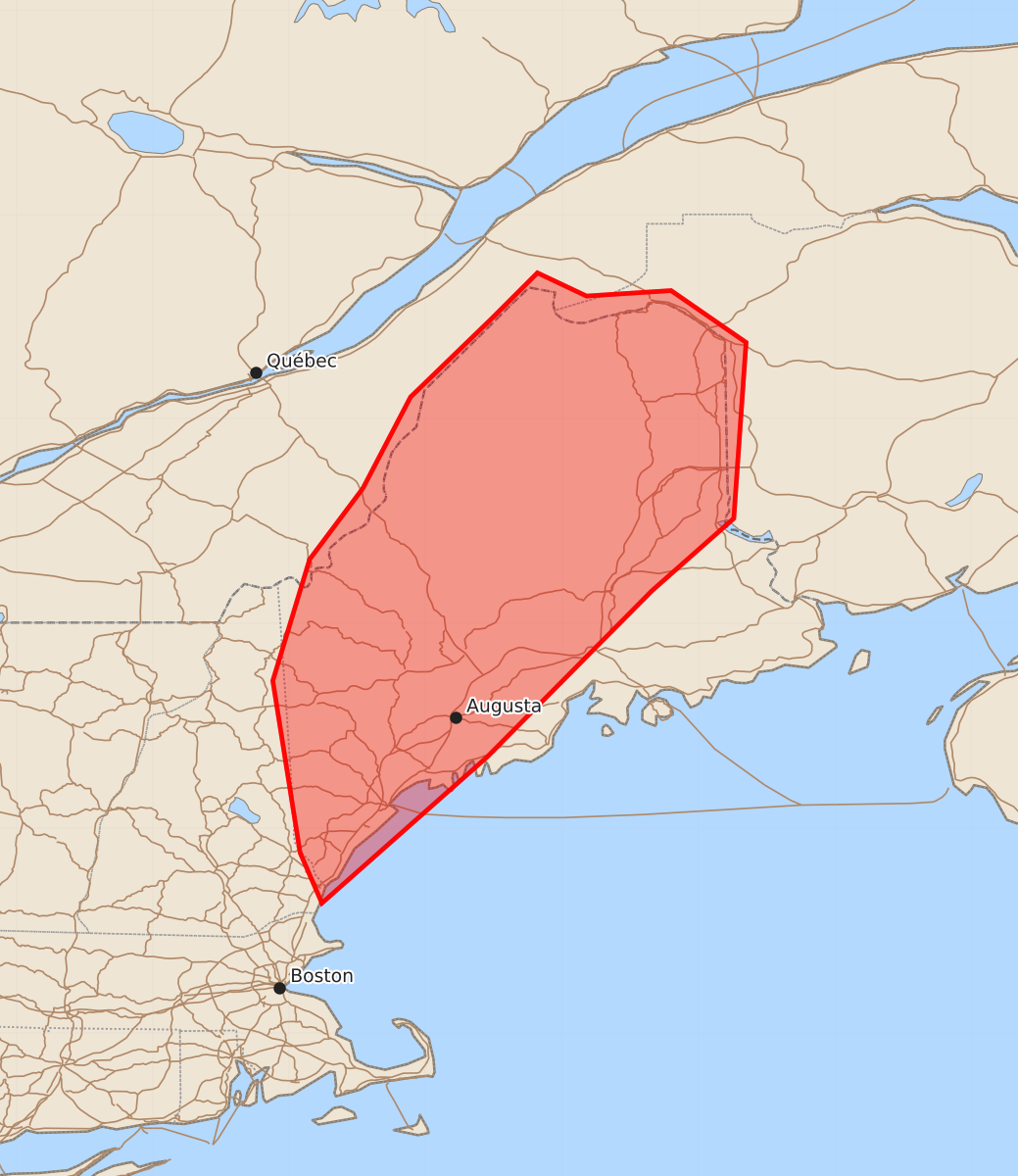
Summary
Severe thunderstorms are expected to increase in coverage and intensity across much of Maine during the afternoon. These storms may produce wind gusts up to 70 mph and hail up to 1.25 inches.
Product Text
000 ACUS11 KWNS 221714 SWOMCD SPC MCD 221714 MEZ000-NHZ000-221845- Mesoscale Discussion 1708 NWS Storm Prediction Center Norman OK 1214 PM CDT Wed Jul 22 2026 Areas affected...A large portion of Maine Concerning...Severe potential...Watch possible Valid 221714Z - 221845Z Probability of Watch Issuance...40 percent SUMMARY...A gradual increase in storm coverage and intensity is expected through the afternoon. A watch may be needed. DISCUSSION...Storms have started to develop across western Maine where temperatures are in the mid 70s with dewpoints in the mid 60s F. Continued heating ahead of this activity will result in greater destabilization this afternoon and additional storm coverage. 35 to 40 knots of shear is in place (per SPC mesoanalysis and regional VWPs) which will aid in storm organization including some supercell structures. The relatively weak instability casts some doubt on the total coverage of severe storms, but if several severe storms can develop, a severe thunderstorm watch may need to be issued. ..Bentley/Thompson.. 07/22/2026 ...Please see www.spc.noaa.gov for graphic product... ATTN...WFO...CAR...GYX... LAT...LON 45997046 46667011 47246951 47576918 47406882 47446820 47066765 45776774 45246834 44026955 42957076 43327092 44587112 45477085 45997046 MOST PROBABLE PEAK TORNADO INTENSITY...UP TO 90 MPH MOST PROBABLE PEAK WIND GUST...55-70 MPH MOST PROBABLE PEAK HAIL SIZE...UP TO 1.25 IN