Mesoscale Discussion 1352
Issued: · Valid: –
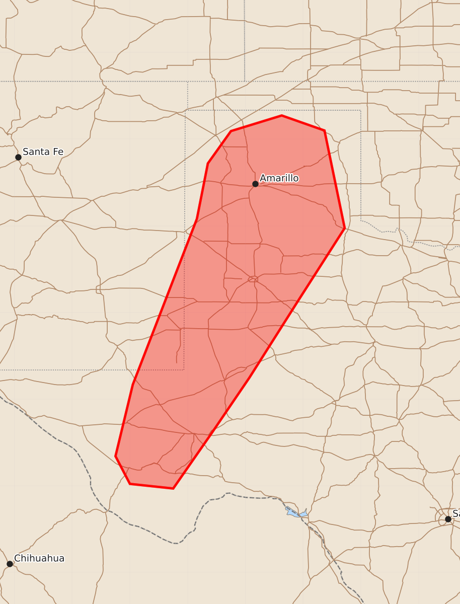
Summary
Isolated thunderstorms capable of producing severe wind gusts of 60 to 80 mph are possible across the Texas Panhandle and southwest Texas late this afternoon into the early evening.
Product Text
000 ACUS11 KWNS 272022 SWOMCD SPC MCD 272021 TXZ000-NMZ000-272245- Mesoscale Discussion 1352 NWS Storm Prediction Center Norman OK 0321 PM CDT Sat Jun 27 2026 Areas affected...the Texas Panhandle into southwest Texas Concerning...Severe potential...Watch unlikely Valid 272021Z - 272245Z Probability of Watch Issuance...5 percent SUMMARY...Thunderstorms capable of isolated severe wind gusts of 60-70+ mph appear possible late this afternoon into early evening. The limited areal coverage of the threat precludes a watch issuance. DISCUSSION...Latest radar and satellite data indicate deepening cumulus within localized confluent zones over the northern and southern TX Panhandle, as well as along the Davis Mountains in southwest TX. Additional mid/high-level cloudiness appears to be associated with a weak disturbance moving through the region, which may aid in isolated to widely scattered storm development amidst an otherwise weakly confluent surface regime. Modification of the 18Z MAF sounding for current surface conditions yields around 1500 J/kg of SBCAPE with a 3-4 km deep, dry sub-cloud layer. Vertical shear is weak, which should limit the potential for storm organization and duration. Nonetheless, the thermodynamic environment appears supportive of isolated severe wind gusts of 60-70+ mph. ..Mead/Guyer.. 06/27/2026 ...Please see www.spc.noaa.gov for graphic product... ATTN...WFO...LUB...AMA...MAF...ABQ... LAT...LON 34620284 35580265 36140225 36410137 36150063 34460028 33180110 31870193 30900259 29950325 30030400 30510425 31750395 34620284 MOST PROBABLE PEAK WIND GUST...65-80 MPH