Day 2 Convective Outlook
Issued: · Valid: –
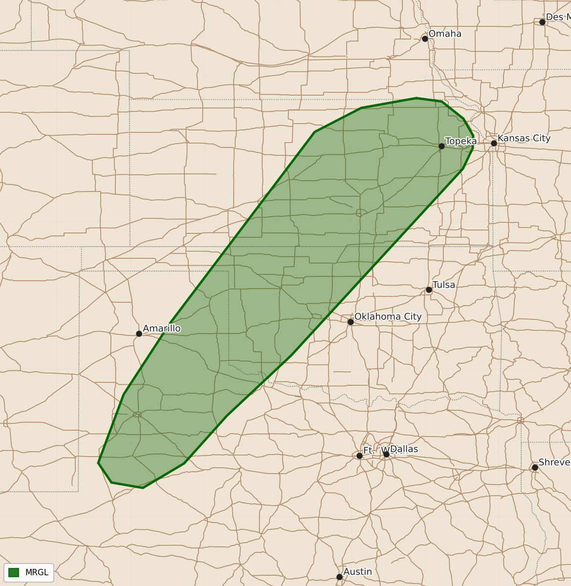
Summary
Isolated severe thunderstorms capable of producing hail and damaging winds may occur across portions of the central and southern Plains on Saturday.
Product Text
000 ACUS02 KWNS 250547 SWODY2 SPC AC 250545 Day 2 Convective Outlook NWS Storm Prediction Center Norman OK 1245 AM CDT Fri Sep 25 2026 Valid 261200Z - 271200Z ...THERE IS A MARGINAL RISK OF SEVERE THUNDERSTORMS FOR PORTIONS OF THE CENTRAL AND SOUTHERN PLAINS... ...SUMMARY... Isolated hail and damaging winds may accompany a few strong to severe thunderstorms across portions of the central and southern Plains Saturday. ...Synopsis... An upper trough and mid-level cutoff low will meander along the West and East Coasts, respectively, while an upper ridge begins to build over the Plains tomorrow (Saturday). A mid-level impulse will traverse the upper ridge and eject from the Rockies, encouraging weak surface low development over the southern Plains. Modest low-level warm-air/moisture advection with a strengthening low-level jet, along with the approach of the aforementioned impulse, will foster enough overlapping vertical wind shear and buoyancy to support an isolated severe threat across the southern Plains. ...Central and Southern Plains... By afternoon, surface temperatures should warm into the 80s F, amid 60s F dewpoints, beneath 7 C/km mid-level lapse rates, resulting in 1500-2500 J/kg MLCAPE across much of central and eastern KS into western TX. As the mid-level impulse approaches and low-level warm-air advection intensifies, thunderstorms should initiate amid a vertical wind profile characterized by some veering and strengthening with height. Given 25-35 kts of effective bulk shear expected, multicells and a couple of transient supercells will be the primary storm modes, capable of isolated severe wind and hail. ..Squitieri.. 09/25/2026 $$