Mesoscale Discussion 1181
Issued: · Valid: –
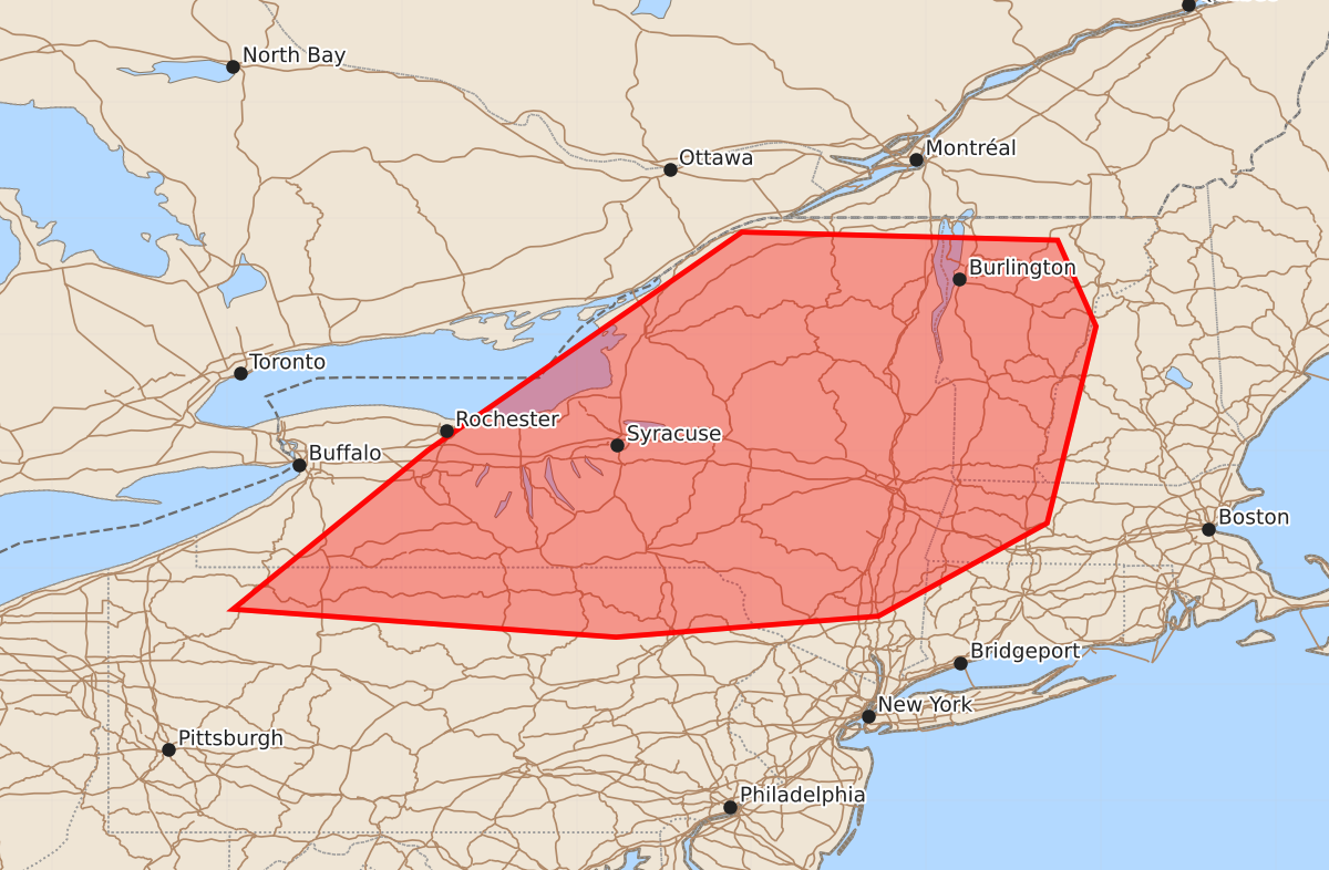
Summary
Thunderstorms moving eastward across portions of the Northeast this afternoon may produce damaging winds and possible tornadoes. The severe weather threat is expected to increase through the early afternoon.
Product Text
000 ACUS11 KWNS 181331 SWOMCD SPC MCD 181331 NHZ000-VTZ000-MAZ000-CTZ000-NYZ000-PAZ000-181530- Mesoscale Discussion 1181 NWS Storm Prediction Center Norman OK 0831 AM CDT Thu Jun 18 2026 Areas affected...portions of the Northeast Concerning...Severe potential...Watch likely Valid 181331Z - 181530Z Probability of Watch Issuance...80 percent SUMMARY...Thunderstorms to shift eastward with potential for damaging wind and perhaps a tornado. DISCUSSION...Low topped convection will continue eastward this morning across portions of the Northeast. Strong southerly flow is ushering in higher dew points ahead of this line. Though cloud cover is prominent, further destabilization is expected to occur through filtered heating into the early afternoon with MLCAPE around 1000 J/kg progged by the afternoon. Given the strong mid-level flow and low-level jet, damaging wind potential will likely increase into the afternoon. Given strong low-level shear profiles, a couple of tornadoes are also possible. A watch will be needed soon to cover this potential. ..Thornton/Hart.. 06/18/2026 ...Please see www.spc.noaa.gov for graphic product... ATTN...WFO...GYX...BOX...BTV...OKX...ALY...BGM...BUF...CTP... PBZ... LAT...LON 43017777 41647945 41407616 41587391 42387246 44077204 44817237 44887508 43017777 MOST PROBABLE PEAK TORNADO INTENSITY...85-110 MPH MOST PROBABLE PEAK WIND GUST...55-70 MPH