Mesoscale Discussion 1135
Issued: · Valid: –
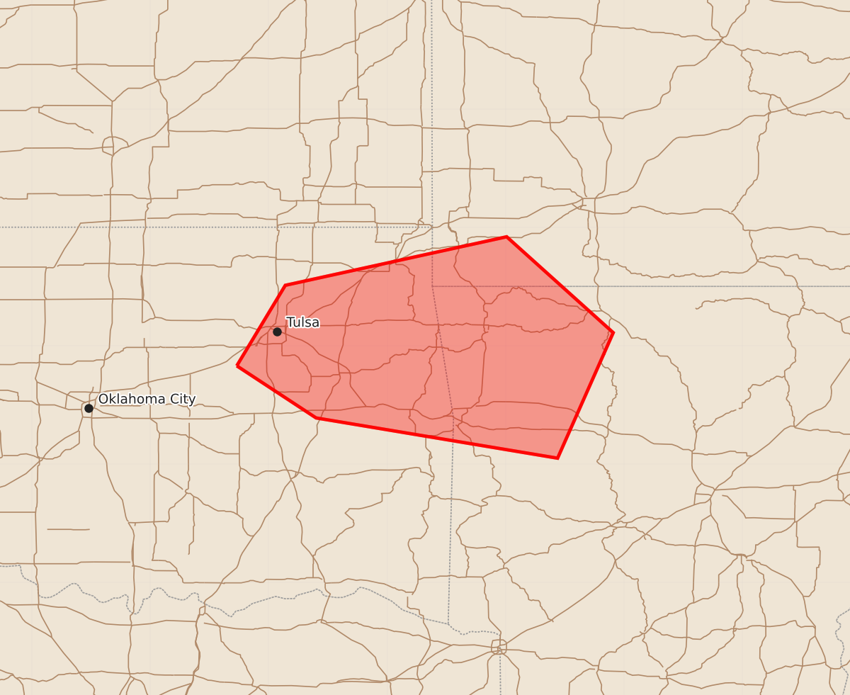
Summary
Severe thunderstorms capable of producing damaging wind gusts over 65 mph will move through northeast Oklahoma and northwest Arkansas until approximately 1:45 AM CDT.
Product Text
000 ACUS11 KWNS 140441 SWOMCD SPC MCD 140440 ARZ000-MOZ000-OKZ000-140645- Mesoscale Discussion 1135 NWS Storm Prediction Center Norman OK 1140 PM CDT Sat Jun 13 2026 Areas affected...Northeast Oklahoma and Northwest Arkansas Concerning...Severe Thunderstorm Watch 332... Valid 140440Z - 140645Z The severe weather threat for Severe Thunderstorm Watch 332 continues. SUMMARY...The risk of damaging winds will spread across northeast OK and northwest AR through 06z. DISCUSSION...Two mature bowing structures noted on radar imagery. One is moving southeastward into the Tulsa metro area, while the second is tracking southeastward through the Joplin area. Both MCSs will likely remain potentially severe for at least a couple more hours, tracking across northeast OK and into northwest AR at over 40kt forward motion. Storms are in a very moist/unstable air mass in vicinity of a remnant outflow boundary. Isolated wind gusts over 65 knots have been reported with these storms this evening, and remain possible through at least 06z. ..Hart.. 06/14/2026 ...Please see www.spc.noaa.gov for graphic product... ATTN...WFO...LZK...SGF...TSA... LAT...LON 35839627 36519586 36929399 36119309 35059356 35399560 35839627 MOST PROBABLE PEAK TORNADO INTENSITY...85-110 MPH MOST PROBABLE PEAK WIND GUST...65-80 MPH MOST PROBABLE PEAK HAIL SIZE...UP TO 1.25 IN