Day 4-8 Convective Outlook
Issued: · Valid: –
Summary
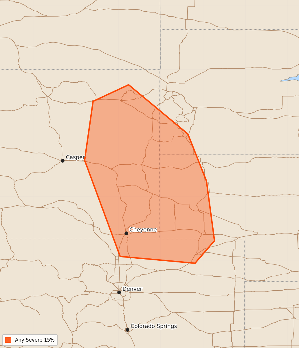
Scattered storms are expected across the central and northern High Plains on Thursday, specifically impacting northern Colorado, eastern Wyoming, and far southwestern South Dakota. Severe weather is also possible across the northern Plains later in the week as atmospheric instability increases.
Product Text
000 ACUS48 KWNS 220856 SWOD48 SPC AC 220855 Day 4-8 Convective Outlook NWS Storm Prediction Center Norman OK 0355 AM CDT Mon Jun 22 2026 Valid 251200Z - 301200Z ...DISCUSSION... ...D4/Thursday - Central/Northern High Plains... Upslope flow will strengthen across the central/northern High Plains on Thursday as a surface low deepens across the southern High Plains. This, combined with a passing mid-level jet streak and shortwave trough, should result in scattered storm development across the High Plains. The most likely corridor will exist from northern Colorado into eastern Wyoming and far southwestern South Dakota where the stronger mid-level flow/forcing overspreads the unstable warm sector. Beyond Day 4 there will likely be multiple days with eventual severe weather probabilities given the amplifying trough across the Northwest and moderate mid-level flow overspreading the northern Plains where instability will also be quite strong. However, at this time, there is considerable uncertainty with the timing/location of each of the mid-level shortwave troughs, and for when the core of the jet streak associated with the Northwest CONUS low ejects into the Plains. Due to these uncertainties, no probabilities have been added beyond Day 4, but eventual probabilities are anticipated in later outlooks. ..Bentley.. 06/22/2026