Mesoscale Discussion 1310
Issued: · Valid: –
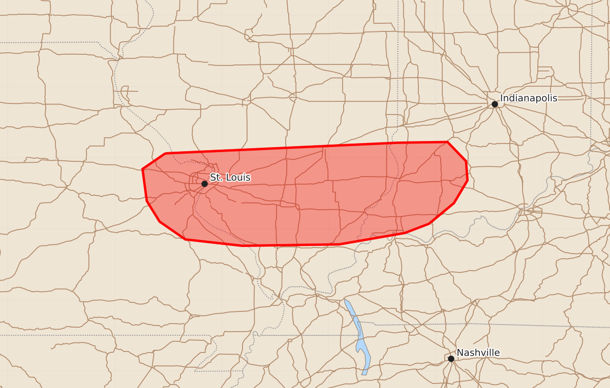
Summary
Scattered thunderstorms may produce sporadic large hail and damaging winds across eastern Missouri, southern Illinois, and southwest Indiana through late afternoon.
Product Text
000 ACUS11 KWNS 251812 SWOMCD SPC MCD 251811 INZ000-KYZ000-ILZ000-MOZ000-252015- Mesoscale Discussion 1310 NWS Storm Prediction Center Norman OK 0111 PM CDT Thu Jun 25 2026 Areas affected...Eastern Missouri into southern Illinois and southwest Indiana Concerning...Severe potential...Watch unlikely Valid 251811Z - 252015Z Probability of Watch Issuance...20 percent SUMMARY...Scattered thunderstorms will continue to develop through late afternoon. Sporadic instances of large hail and damaging winds appear possible, but will most likely remain too isolated to warrant watch issuance. DISCUSSION...Over the past hour, thunderstorms have been slowly deepening in the St. Louis area and eastward into southern IL. This activity appears to be driven primarily by a combination of weak low-level confluence and glancing ascent from a passing upper-level wave to the north across central/northern IL. Despite the weak ascent, very moist low-level conditions coupled with continued diurnal warming are quickly eroding any lingering MLCIN and should result in scattered to somewhat widespread thunderstorm coverage from eastern MO to southwest IN over the next several hours. The moist low-level conditions are also compensating for the otherwise limited mid-level lapse rates and supporting MLCAPE values on the order of 2000 J/kg. Recent VWP observations from KLSX are sampling 0-6 km bulk wind values on the order of 20-25 knots, which aligns well with recent RRFS solutions and suggests some storm organization is possible, including the potential for transient supercell structures across southern IL where deep-layer wind shear should be slightly stronger. However, weak low-level winds will likely promote outflow-dominant convection that may modulate storm lifespans and favor clustered storm modes. Nonetheless, sporadic instances of large hail (possibly as high as 1.5 inches) and damaging winds appear possible through late afternoon based on the convective environment and output from the past few RRFS solutions. ..Moore/Guyer.. 06/25/2026 ...Please see www.spc.noaa.gov for graphic product... ATTN...WFO...LMK...IND...PAH...ILX...LSX... LAT...LON 39069079 39218752 39228683 38958657 38688655 38368674 38078709 37948743 37788835 37768971 37859051 38109087 38399105 38849111 39069079 MOST PROBABLE PEAK WIND GUST...UP TO 60 MPH MOST PROBABLE PEAK HAIL SIZE...1.00-1.75 IN