Mesoscale Discussion 2270
Issued: · Valid: –
Summary
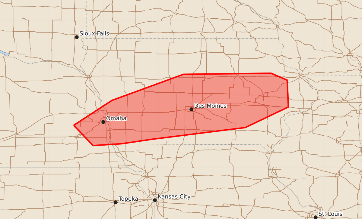
Severe thunderstorms capable of producing damaging wind gusts and occasional tornadoes may develop across extreme eastern Nebraska and central Iowa through late afternoon. These storms could include intense wind gusts and small hail.
Product Text
000 ACUS11 KWNS 081949 SWOMCD SPC MCD 081949 IAZ000-NEZ000-082145- Mesoscale Discussion 2270 NWS Storm Prediction Center Norman OK 0249 PM CDT Tue Sep 08 2026 Areas affected...portions of extreme eastern Nebraska into central Iowa Concerning...Severe potential...Watch possible Valid 081949Z - 082145Z Probability of Watch Issuance...60 percent SUMMARY...Thunderstorms should gradually increase in coverage and intensity as a surface cold front approaches. The strongest storms may be accompanied by at least a few severe gusts and perhaps a tornado or two. Convective trends are being monitored for the need of a WW issuance. DISCUSSION...A relatively broad swath of precipitation is currently overspreading central NE into the northern half of IA, ahead of a surface cold front, which has limited insolation and boundary-layer destabilization across much of the region thus far. However, ample boundary-layer mixing is underway to the southern periphery of this rain band, where surface temperatures have heated into the 90s F (to near 100 F in some spots). Given low to mid 70s F surface dewpoints, MLCAPE has boosted to over 2000 J/kg despite mediocre mid-level lapse rates. It is unclear precisely when storms will initiate since much of the available deep-layer ascent will glance the region to the north. Nonetheless, a pre-frontal trough is gradually drifting east across far southeastern NE, and this boundary may serve as a potential focusing mechanism for more robust surface based thunderstorm development over the next few hours. Storms may initially be semi-discrete and anafrontal in nature. As the storms mature, and assuming they can propagate into the warm sector, then surface-based convection will become possible. These storms would most likely become an MCS capable of producing a few severe gusts and perhaps a couple of QLCS tornadoes. A Severe Thunderstorm Watch may be needed when convective initiation and intensification become more apparent. ..Squitieri/Hart.. 09/08/2026 ...Please see www.spc.noaa.gov for graphic product... ATTN...WFO...DVN...DMX...OAX... LAT...LON 41149681 41829577 42539383 42569145 42379101 41649098 41089215 40769469 40649550 40599628 41149681 MOST PROBABLE PEAK TORNADO INTENSITY...UP TO 90 MPH MOST PROBABLE PEAK WIND GUST...55-70 MPH MOST PROBABLE PEAK HAIL SIZE...UP TO 1.25 IN