Day 4-8 Convective Outlook
Issued: · Valid: –
Summary
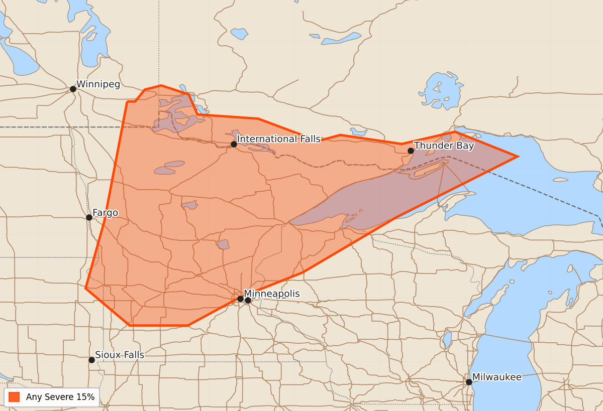
Severe weather is possible across the upper Mississippi Valley starting Monday, with the potential for strong to extreme instability. The timing and exact location of the most intense storms remain uncertain due to shifting weather patterns throughout the early part of the week.
Product Text
000 ACUS48 KWNS 260858 SWOD48 SPC AC 260857 Day 4-8 Convective Outlook NWS Storm Prediction Center Norman OK 0357 AM CDT Fri Jun 26 2026 Valid 291200Z - 041200Z ...DISCUSSION... An upper-level trough centered within the Intermountain West will continue pivoting northeast through the northern Plains on Monday. This feature will be fairly meridional in character. The strongest height falls are likely to occur after 00Z within North Dakota. To the east, an amplified upper ridge will be in place. Moisture advection will continue in the upper Mississippi Valley given the southerly low levels winds. Strong to extreme buoyancy is expected to develop as a result. While this pattern does suggest potential for severe weather, there is still uncertainty as to where the most favorable environment will be given the influence of convection that could occur late on Sunday night into early Monday morning. The 15% area has been maintained this cycle given the potential for a an MCS to develop, but modification seems likely in the coming days given the mesoscale details that will play a large role in where severe weather ultimately occurs. From Tuesday onward, the strongest mid-level flow will shift into Canada as the western upper trough becomes more broad. A large reservoir of strong to extreme buoyancy is still forecast to be in place underneath the ridge. While areas of severe weather are possible, they will be highly tied to mesoscale features as larger scale features will become more nebulous and deep-layer shear will weaken through the remainder of the period. As a result, predictability is reduced. ..Wendt.. 06/26/2026