Mesoscale Discussion 1411
Issued: · Valid: –
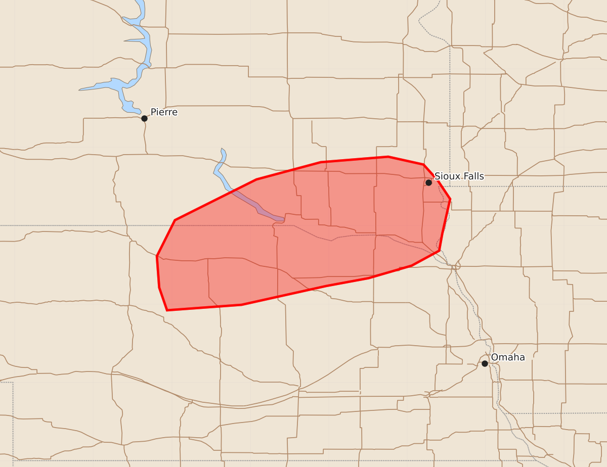
Summary
Severe thunderstorms capable of producing 60-80 mph wind gusts, isolated hail, and a brief tornado will move through north-central Nebraska into southeast South Dakota during the early overnight hours.
Product Text
000 ACUS11 KWNS 010628 SWOMCD SPC MCD 010628 IAZ000-SDZ000-NEZ000-010800- Mesoscale Discussion 1411 NWS Storm Prediction Center Norman OK 0128 AM CDT Wed Jul 01 2026 Areas affected...Parts of north-central NE into southeast SD Concerning...Severe Thunderstorm Watch 426...427... Valid 010628Z - 010800Z The severe weather threat for Severe Thunderstorm Watch 426, 427 continues. SUMMARY...A threat for 60-80 mph gusts and possibly a brief tornado will spread northeastward through the early overnight hours. Isolated hail is also possible. DISCUSSION...A compact but intense storm cluster is moving across parts of the Nebraska Sand Hills early this morning. This cluster has a history of producing measured severe gusts, including 76 mph at KTIF. In the short term, this cluster should continue to move northeastward along and just north of a warm front, where a corridor of 2000-3000 J/kg of MLCAPE (and similar magnitudes of MUCAPE north of the front) will gradually shift northward in advance of this cluster. The pre-storm VWP from KLNX depicted substantial veering of winds with height and 40+ kt of effective shear, which will continue to support embedded mesocyclones and possibly a brief tornado with this cluster through the early morning. Otherwise, gusts of 60-80 mph will remain possible from north-central NE into extreme southeast SD. Longevity of the ongoing cluster remains somewhat uncertain, due to the influence of decayed convection and attendant pocket of relative dryness/stability that is moving northward across south-central NE. However, a favorable environment is expected to remain in place through at least a narrow corridor into a larger portion of southeast SD overnight, which will support a continued threat of severe gusts. Storms developing within a warm-advection regime ahead of the primary cluster may also pose an isolated hail threat. ..Dean.. 07/01/2026 ...Please see www.spc.noaa.gov for graphic product... ATTN...WFO...FSD...OAX...LBF...UNR... LAT...LON 42239803 41999911 41920006 42210016 42610019 43079996 43599892 43819810 43889724 43789679 43589661 43349645 42909655 42689659 42499694 42339749 42239803 MOST PROBABLE PEAK TORNADO INTENSITY...UP TO 90 MPH MOST PROBABLE PEAK WIND GUST...65-80 MPH MOST PROBABLE PEAK HAIL SIZE...1.00-1.75 IN