Mesoscale Discussion 1090
Issued: · Valid: –
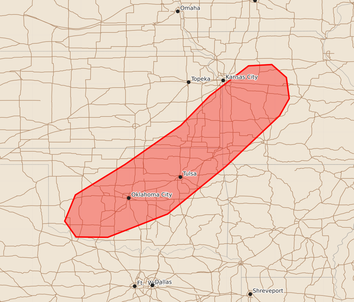
Summary
Severe thunderstorms capable of producing damaging wind gusts, large hail, and possible tornadoes are expected this afternoon across southeastern Kansas, western Missouri, and northeastern Oklahoma. The storms will increase in coverage throughout the afternoon, bringing a threat of severe weather to these areas.
Product Text
000 ACUS11 KWNS 111819 SWOMCD SPC MCD 111818 MOZ000-ARZ000-OKZ000-KSZ000-112015- Mesoscale Discussion 1090 NWS Storm Prediction Center Norman OK 0118 PM CDT Thu Jun 11 2026 Areas affected...southeastern Kansas...western Missouri...and northeastern Oklahoma Concerning...Severe potential...Watch likely Valid 111818Z - 112015Z Probability of Watch Issuance...80 percent SUMMARY...Increasing thunderstorm coverage is expected this afternoon along a cold front in southeastern Kansas, western Missouri, and Oklahoma. Severe wind gusts and some large hail will be the primary threats. DISCUSSION...A cold front -- currently draped southwestward from central IA through northwestern OK -- is expected to serve as a focus for thunderstorm development this afternoon. As the attendant 1002-mb surface low slides northeastward through IA, the cold front will continue pushing southeastward and impinge on a destabilizing warm sector. Per current mesoanalysis and water vapor imagery, a mid-level jet core is currently located over eastern NE and western IA, placing the warm sector in the right-entrance quadrant of the jet. Associated quasi-geostrophic ascent aided by frontal convergence should promote extensive thunderstorm development this afternoon across the area. Visible satellite imagery suggests that any remaining convective inhibition is waning, driven by temperatures warming into the upper 80s / low 90s F ahead of the front. Some deeper updraft cores are already evident in northwestern MO, and vertical development is expected to continue southwestward along the front with time. Large CAPE (3000+ J/kg), minimal inhibition, and predominantly line-parallel bulk shear should yield relatively quick upscale growth. Strong wind gusts and hail are the primary threats with this activity. Shear profiles are slightly larger and more line-perpendicular with latitude, so more persistent discrete structures/supercells may be possible in eastern KS and western MO. Some tornado threat exists in this area, particularly around mid-/late-afternoon as low-level SRH increases, but it will be generally tempered by upscale tendencies. One or more watches will likely be needed to cover these threats. ..Flournoy/Gleason.. 06/11/2026 ...Please see www.spc.noaa.gov for graphic product... ATTN...WFO...LSX...SGF...EAX...TSA...TOP...ICT...OUN... LAT...LON 36459451 34979632 34259817 34269915 34759950 35569917 36509764 37719591 38629502 39559382 39599310 39199265 38549256 38019286 36459451 MOST PROBABLE PEAK TORNADO INTENSITY...85-110 MPH MOST PROBABLE PEAK WIND GUST...65-80 MPH MOST PROBABLE PEAK HAIL SIZE...1.50-2.50 IN