Mesoscale Discussion 1046
Issued: · Valid: –
Summary
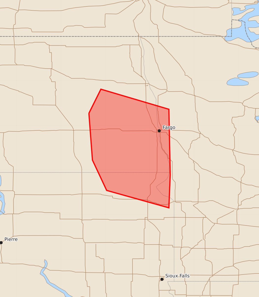
Isolated to scattered strong thunderstorms capable of producing large hail and a tornado or two may develop across parts of the eastern Dakotas and western Minnesota between 3 PM and 5 PM CDT. These storms could evolve into supercells with significant severe potential.
Product Text
000 ACUS11 KWNS 091836 SWOMCD SPC MCD 091836 MNZ000-SDZ000-NDZ000-092030- Mesoscale Discussion 1046 NWS Storm Prediction Center Norman OK 0136 PM CDT Tue Jun 09 2026 Areas affected...parts of the eastern Dakotas and adjacent western Minnesota Concerning...Severe potential...Watch possible Valid 091836Z - 092030Z Probability of Watch Issuance...40 percent SUMMARY...Isolated to widely scattered strong thunderstorm development is possible through 3-5 PM CDT. This may include evolving supercell structures posing the risk for large hail and a tornado or two. Trends are being monitored for the possibility of a severe weather watch. DISCUSSION...A plume of warm and increasingly capping elevated mixed-layer air continues to nose northeastward into and through much of the northern Great Plains. However, downstream of a mesoscale convective vortex now migrating northeastward across the Aberdeen SD vicinity, deepening convective development is evident within a seasonably moist boundary-layer characterized by surface dew points near 70F, which appear to be supporting sizable CAPE on the order of 3000 J/kg. Inhibition near the western Minnesota/Dakotas state border vicinity remains weaker compared to upstream, but further warming at mid-levels (particularly around 700 mb) through the remainder of the afternoon casts some uncertainty concerning potential storm intensities and sustenance. This is reflected in substantive spread among the convection allowing guidance. However, given the magnitude of the potential instability, deep-layer shear appears at least marginally conducive to the evolution of supercell structures with sustained thunderstorm development. Modest clockwise curved low-level hodographs could support the risk for a tornado, in addition to large hail and locally damaging wind gusts. ..Kerr/Mosier.. 06/09/2026 ...Please see www.spc.noaa.gov for graphic product... ATTN...WFO...FGF...ABR...BIS... LAT...LON 47279837 47819810 47369657 45899654 45159657 45549797 46229829 47279837 MOST PROBABLE PEAK TORNADO INTENSITY...85-110 MPH MOST PROBABLE PEAK WIND GUST...UP TO 60 MPH MOST PROBABLE PEAK HAIL SIZE...2.00-3.50 IN