Mesoscale Discussion 2056
Issued: · Valid: –
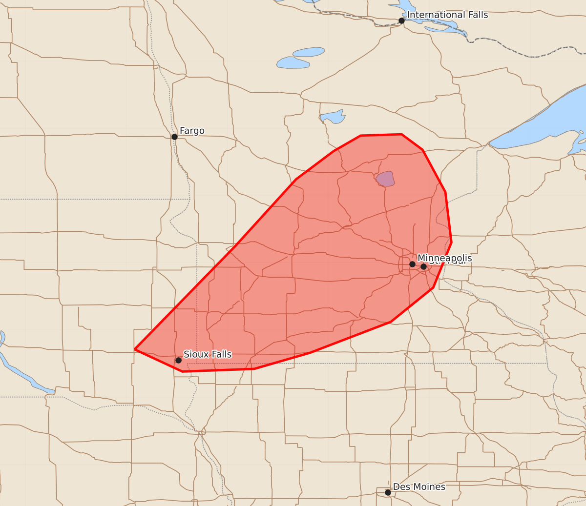
Summary
Severe storms capable of producing large hail, damaging wind gusts, and a possible tornado may develop across portions of central and southwestern Minnesota and far eastern South Dakota through the evening. The severity of these storms is expected to increase as they develop after sunset.
Product Text
000 ACUS11 KWNS 202232 SWOMCD SPC MCD 202231 WIZ000-MNZ000-IAZ000-SDZ000-210030- Mesoscale Discussion 2056 NWS Storm Prediction Center Norman OK 0531 PM CDT Thu Aug 20 2026 Areas affected...portions of central into southwestern Minnesota and far eastern South Dakota Concerning...Severe potential...Watch possible Valid 202231Z - 210030Z Probability of Watch Issuance...60 percent SUMMARY...The risk for severe hail will increase through the evening hours as storms gradually develop through the evening. A few severe gusts and a tornado or two may also occur. Timing of storm development is uncertain, but convective trends will be closely monitored for the need of a WW issuance. DISCUSSION...A few discrete storms have developed and sustained themselves along a surface trough over northern MN, where MRMS MESH depicts some hail potentially falling with these storms. As the surface trough continues to move southeast, storms should gradually increase in coverage and intensity, especially after 0Z. Surface temperatures approaching 80 F, amid mid 60s F dewpoints and 7-8 C/km boundary-layer lapse rates, is yielding over 2000 J/kg MLCAPE. Furthermore, increased southwesterly 850 mb flow beneath modest 500 mb westerlies is contributing to 40 kts of effective bulk shear, especially over central and southern MN. Currently, the MPX VAD shows a modestly curved and elongated hodograph, supportive of supercell structures. The current thinking is that any storm that can mature and sustain itself in this environment will become supercellular, accompanied by a severe hail threat (some potentially exceeding 2 inches in diameter). A few severe gusts may also occur, and given the appreciable low-level hodograph, a tornado or two cannot be rule out either. Visible satellite shows an overall lack of agitated CU, with several billow clouds remaining (indicative of some residual stability). It is thus unclear when convective initiation and the subsequent need for a WW issuance will occur. Given the favorable ambient environment though, convective trends will be closely monitored. ..Squitieri/Guyer.. 08/20/2026 ...Please see www.spc.noaa.gov for graphic product... ATTN...WFO...DLH...MPX...FGF...FSD...ABR... LAT...LON 43719738 45259588 46249498 46669442 46899402 46919341 46689310 46059276 45309267 44639294 44129357 43669477 43429560 43389667 43719738 MOST PROBABLE PEAK TORNADO INTENSITY...UP TO 90 MPH MOST PROBABLE PEAK WIND GUST...55-70 MPH MOST PROBABLE PEAK HAIL SIZE...1.50-2.50 IN